User: | Open Learning Faculty Member:
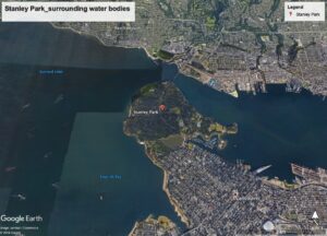
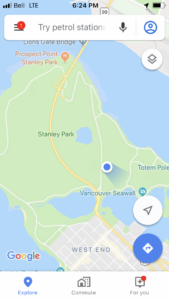
The location I have chosen to study is Stanley Park, in Vancouver. Stanley Park is an urban public park that covers 404.9 hectares, located in the lower mainland region of British Columbia. The park is situated between downtown Vancouver (south), and the ocean water of Burrard Inlet and English Bay (north, east, and west; Photo 1).
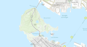
The elevation ranges from sea level to 76 m throughout the park (Photo 2). Prospect point located in the northern part of the park, is the topographic peak of the park. The vegetation within Stanley Park consists primarily of forest (conifers and deciduous). The Vancouver city park is located on Federal land that is leased to the City of Vancouver, and was established in 1888 by Lord Stanley.
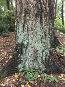
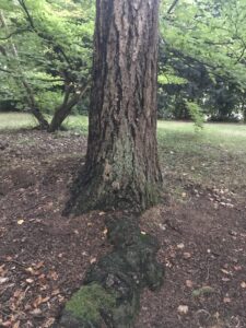
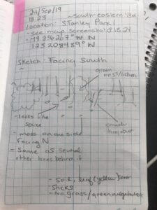
On 24 September 2019 I observed a small area of the forest (100m line of trees North to South; Photo 3 – 5) in the southeastern corner of the Park (Photo 6). I visited from 18:23 to 19:00, before sunset (19:05). The weather and general site conditions consisted of low light, light wind, and 14°C.
Potential subjects of study:
- Trees (ie. coniferous and/or deciduous)
- Mosses
- Lichens
Potential research questions:
- What physical conditions in Stanley Park favour the growth of lichen and/or moss on trees?
- Is there a pattern of distribution of lichen and/or moss species across Stanley Park?
- Does lichen and/or moss grow on all tree species in the Stanley Park?
Sources:
B.C. Conservation Data Centre: CDC iMap [web application]. 2019. Victoria, British Columbia, Canada. Available: http://maps.gov.bc.ca/ess/sv/cdc/ (24 September 2019).
Google. (n.d.). Stanley Park. Retrieved from: https://www.google.com/maps/place/Stanley+Park/@49.3064903,-123.1521274,14.38z/data=!4m5!3m4!1s0x5486718cad26e4a3:0x364a639db409e216!8m2!3d49.3042584!4d-123.1442522