User: | Open Learning Faculty Member:
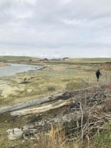
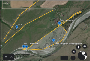
My chosen study area will consist of observing a varied riparian zone along the Highwood River, southwest of the town of High River, Alberta. This location is just 300 meters south of my house and has suffered major damages from the 2013 floods. The Highwood river originates from the collection of water from the slopes of Mount Arethusa, flowing southeast towards the Bow River. This study area is surrounded by cultivated, pasture and rangelands with pockets of native grasses. I have decided to divide approximately a 1km area into three sections due to its contrasting ecosystems.
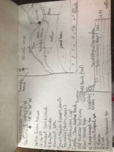
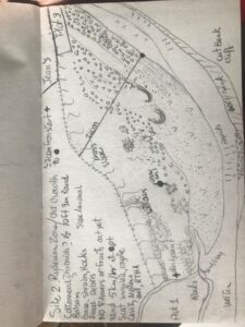
In plot 1 I am observing 80 meters of a 150 meter section of sandstone plateau caused by old erosion (pre flood) exposing various sedimentary layers where moss, shrubs, flowers and grassy vegetation is sparsely growing across the northern rocky slope just below a 4ft bank housing old swallow cavity nests.
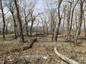
Plot 2 spans approximately 700 meters east into a old growth forest with a gentle slope till it reaches river elevation. Black cottonwood (Populus trichocarpa), Balsam poplars (Populus balsamifera) and hybrids are to be identified once the trees leaf out. Various shrubs and plant life fill the forest floor from short grasses to tall, willows and flowers. This area has massive debris piles and downed trees and river rock spread at least 200 meters from the river edge.
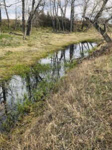
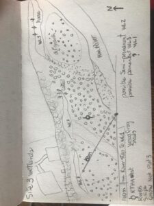
My last plot is a wetland section roughly 150 meters from the river edge spanning 500 meters east, tucked below an old cut bank of approximately 9 feet behind the house of our neighbour. These are 3 fluctuating hydroperiods which were influenced by the change in topography from the floods.
My initial observations started on May 07, 2020 at 10:30 and ended approximately at 13:00 hour on an overcast day, with winds ranging from 2-8 km/hr on average. Because of the late spring, my observations lack identification of flora mostly due to the phenological timing. However, we are in the middle of bird migration and some are already having territorial disputes, are mating and collecting nesting material. Tracks and scat were also noted (ungulates, canids, lagomorphs, rodents).
Questions:
How old on average are the trees in this riparian zone? Can I identify if cottonwood types (black or plains), balsam poplar (Populus balsamifera) or hybrids dominate the area?
Does the vegetation differ in each plot? does the pattern and communities change with environmental gradient? What are the succession stages in each plot?
What are the native species, invasive species and introduced species? Which ones are thriving? Is there a different pattern in each plot? Are soil types and recent processes big factors for community diversity and distribution?
What are the main ecosystem disturbances in each plot? Which one has greater chances of thriving despite the disturbances?
Which plot is most attractive for fauna diversity? How important are riparian zones for wildlife? Are riparian zone processes and successional events too volatile for specie site fidelity?

It sounds like a nice study site and there will be some good questions here. Great field journal as well. At this stage you shouldn’t have your plots picked out, but rather focus on the gradient and what it is like and what types of vegetation, soil and animal changes you can see to help with forming your questions. It would be good to have a description of how these different areas are linked and how they grade into one another. As well, if you do keep these plots, make sure they are representative of the larger area.