Blog Post 5

Background: I completed five transects each five meters apart.  Each transect consisted of five 1m2 sampling areas alternating from left to right 1 meter apart. For a total of 25 sampled spots. My sampling unit was the presence of fomitopsis pinicula in a 1m2 area. I only found 4 of the fungi in my sampling area. They were all living on dead tree stumps.  I think the presence of the fungi is very dependent on the location in the forest because it mostly grows on dead stumps. From my observations certain areas of the forest have very few stumps compared to other areas.


Difficulties: There were several problems I ran into:

  1. I used a measuring tape to measure out the distances which was time consuming and inaccurate at measuring the 1m2
  2. My study area is on a mountain which is difficult to walk up and down making the process arduous.
  3. I did not find very many samples of the fungi which I know can lead to statistical errors because of the low number of samples.
  4. The 1m2 was used because this is the most common unit I saw. I think because the fungi are not like grasses or other plants that can grow everywhere on the ground coverage this may not be an efficient unit to measure.


Modifications: I plan on making the following modifications:

  • Increasing the transect size to cover more ground. I think increasing it from 5 meters to 10 or 20 meters. An increase in my unit from 1 m 2 may also help.
  • Using a pre measured string to measure the areas to have more accuracy in the measurement.


The modifications would hopefully help me find more of the fungi and have more accurate measurements.

Blog Post 5 : Design Reflection

Blog Post 5: Design Reflections

It was difficult to measure different sample area, every time I observed. Each area, preserved hill, ornamental steps, ornamental gardens were not really huge, randomly selected quadrat easily overlapped the area that I already observed, which increases error in data accuracy. Therefore, I though it might have been better if it followed systematic sampling techniques rather than random sampling technique. Also, in preserved hill there was not much dry/green grass, barely any vegetation could be seen. In ornamental steps green grass did not exist however, green clover was easy to observe. Although there were a lots of points that were missing however, the results quantitatively supported my hypothesis that there were more fresh plants observed as the landscape was more intervened with artificial modification.

To make more accurate, credible and supportive data I would make several changes. First, I will change my sampling technique from random to systematic. Also, considering the environment there might not be an vegetation the denominator will be the area of the quadrat 100 cm^2. Finally, considering other species of vegetation exists, I would change the numerator will be changed to the green surface area in that quadrat. This will test more closer to the hypothesis I was about to test, also it will reduce the error, and the conditions of sampling is more refined to support the hypothesis.


Blog Post 5: Design Reflections

  1. My sampling method was using a 0.5 by 1.0-meter quadrat to measure the abundance of the Ivy in light and dark environments. There was not too much difficulty when collecting data this way as the results I observed were not surprising. It was a bit difficult to subjectively determine the percent cover but I marked my quadrat at 25cm and 50cm intervals to show an area of 25% to assist in judging the percent cover. Some replicates included other plants so observation of measurement had to be done without taking those into account. I am considering changing to a point count way of measuring as this may change the precision of my measurements but am wondering if this will be suitable for the English Ivy as some replicates had a large abundance that individual Ivy leaves would be difficult to count and I would need to determine what counted as a leaf being “inside” the quadrat. I will consider this however, percent cover did yield good results.
  2. will be as a comment 🙂

Blog Post 5. Design Reflections

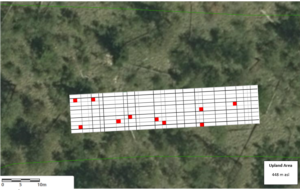
My initial field data involved the identification of lichen genera, and the collection of presence-absence data for epiphytic lichen growing on the trunk bark of 4 different tree families (Pinaceae, Cupressaceae, Aceraceae, Betulaceae) within the south western region (10-19m elevation) of Stanley Park. Individual tree trunks from each family were sampled at sites systematically, along a transect (Lees Trail). A total of 5 replicate stations along Lees trail were chosen based on accessibility, at regular intervals of approximately 150 m to span the entire ~ 1km long transect. At each point along the transect, a random number of steps were taken into the forested area (>10m) and one individual from each tree family (if available) was selected for observation. The lichen genera present on the tree trunk (< 1.4m height) were identified (using a guide), and the presence/absence was recorded for each tree.

Did you have any difficulties in implementing your sampling strategy? If yes, what were these difficulties?

I had difficulties finding trees within the deciduous families (hardwood/angiosperm) Aceraceae and Betulaceae. Often there was only one individual of either  family at each station, and coniferous members of the Pinaceae and Cupressaceae famiies always dominated the stand. Additionally, all vine maples (family Aceraceae) were much younger than the other trees measured, making it difficult to compare lichen data across tree families.

It was difficult to differentiate Hemlock and Douglas fir tree species, and they often had the same lichen genera present on their bark. I solved this in the field by grouping observations by tree family. It was difficult to identify lichen in the field, and the differentiation between Cladonia sp. (squamulose) and Platismatia sp. (foliose) lichen had to be done using photographs and physical samples upon return from the field.

It was time consuming to photograph and identify lichen on 3-4 trees, per replicate station. A recent seasonal change in weather has made spending time in Stanley Park more difficult due to the increased amount of rain.

Was the data that you collected surprising in any way?

I found it surprising that all tree families measured, had visible dust lichen (Lepraria sp.) except for the two maple trees (family Aceraceae). Western Red Cedars seemed to have the most diverse genera of lichen present on the trunk bark.

Squamulose lichen was present with and without secondary thallus structures (podetia). The Cladonia genus is known to develop cup-shaped fruticose podetia. Cladonia sp. (identified as Cladonia ochroclora ) had developed visible fruticose podetia (secondary thallus) more frequently on Western Red Cedar (family Cupressaceae) and Alder (family Betulaceae) compared to Douglas Fir and Western Hemlock (family Pinaceae).

Do you plan to continue to collect data using the same technique, or do you need to modify your approach? If you will modify your approach, explain briefly how you think your modification will improve your research.

I will continue selecting replicates systemically along the length of each trail. However, I plan to change my method by selecting trees along the very edge of the trail, to reduce any potential confounding edge- effects on lichen distribution. This type of sample selection will improve my research because replicates will be more comparable. Overall, by selecting replicates at the very edge of the trail (stand), the replicate data will be more comparable due to the potentially reduced confounding effects of location within the stand, aspect, humidity, and differential exposure to radiation.

I plan to sample 10 Western Red Cedars (Cupressaceae) and 10 Douglas fir or Western Hemlock (Family Pinaceae), within each sub-area. I plan to sample trees randomly along each trail transect, using a random number generator to select a number of steps greater than 10, but less than 20. This will maintain an aspect of random sampling in my sample selection method.

I will maintain the same data collection technique; presence absence of lichen genera below 1.4m trunk height, on all aspects of the tree trunk (north, east, west, and south- facing sides). To help identify lichen genera in the field, I plan to collect unit shape category for each replicate. I will record whether the lichen is: powdery, crustose, squamulose, foliose, or fruticose in nature. This adds a categorical morphological response variable, and also provides an alternative identification method if the genera cannot be resolved in the field.

I plan to start collecting the circumference at breast height of every tree sampled, to approximate tree age. Age will represent a potential biotic predictor variable. I will also note a description of the ground cover at each site, ranging from soil and decaying organic matter (ie. branches, woody debris, and leaves/needles) to dense vegetation (ie. understory and young trees).

Post 5: Design Reflections

My sampling strategy was overall pretty easy to implement. The main difficulty that I ran in to was trying to be at the park every day during the same time period. There were a few days that were missed due to traffic conditions on the drive home when I was transferred to a different location for work. There were also a few days were I was at the World Sleep Symposium where my husband went to the park on my behalf but there were some inconsistencies with his measurements compared to mine that I suspect are user error differences.

One difficulty that I’m foreseeing if I continue to collect data is the upcoming time change as well as sunset rapidly descending upon my collection time. Currently I’m measuring from 17:30-17:45 every day. Sunset is currently at 18:08 and gets a few minutes earlier each day. I anticipate that the darkness will drastically change my collection numbers and I’m unsure if I should continue a 24 hr cycle of measurement after the time change and measure at 16:30-16:45 or if I should stay with the accepted clock time. These may not come up as I anticipate that I will stop collecting data before the time change, as far as it pertains to this report, though I may continue on my own accord out of sheer curiosity.

Blog Post #5 – Design Reflections

At first I wasn’t sure how I would measure the change in leaf colour with changes in humidity levels, but I think measuring the percentage of changed leaves this way is going okay. I couldn’t think of another efficient way of collecting this data. After four observations and noting down the humidity levels each day of observation, I may need to do more, perhaps every day or two, instead of three days like what I’m doing currently. This way, I may be able to see changes more steadily than a big change. I’m also going to bring out a humidity detector to more accurately measure the humidity in the park at that time.

I am surprised to see though, that leaves at the top of the tree changed much faster than those closer to the bottom. As well as seeing that leaves further on the outside of the branches change faster than the inner parts of the branches, where it is also more dense.

I’m not sure if I’ll keep how the data is shown in a table, but there is a way to better sum up all the information with a different visual.

Blog Post 5: Design Reflections

Although my data collection may be more straightforward then other studies that involve in depth measurements and larger study areas, I still found I had some difficulty solidifying my study areas. Due to the fact the pond I am studying is irregularity shaped it was difficult to create study areas that were the exact same area and consistent with one another (i.e. similar amount of grassed area, pond water depth, etc). I used air photos and online mapping tools to create a rectangle surrounding the pond and then divided the rectangle evenly in four. The quadrants were divided by direction which was one pro as that is consistent, NW, NE, SE, SW and will be utilized as a variable. I found it difficult to conduct accurate population density of the species by counting for the heavily populated species since it was difficulty to differentiate between individuals and keep track, to counteract this I decided to create a range rather than an exact number. This may be subjective and difficult to confirm accuracy, so I repeated this population count once a week for 8 weeks. There was little to no variation between each visit, especially with mature vegetation like trees. However, I also believe this information is bias to the current season being fall compared to obviously Winter, Spring and Summer. I am confident supplementary research will assist me in supporting my data and I look forward to research pond management and diversity further.

Blog Post 5: Design Reflections

During my initial data collection, summarised in my Small Assignment 1 there were a few difficulties in implementing my sampling strategy. I was using 1.5 m by 1.5 m quadrats (2.25 m2) as my sampling unit along a transect, which in the field I measured out and delineated with tent pegs at each location (see Figure 1 below). I found this to be inefficient and time consuming. I also calculated the percentage slope by using tent pegs and measuring rise over run (over a 1 m distance), again I found myself measuring 1 m out at every quadrat, which again was time consuming.

Figure 1. Illustrating an east-west transect, with 1.5 m by 1.5 m quadrats (2.25 m2) spaced 5 m apart, alternating north and south of the transect.

The data was somewhat surprising, in all five replicates there was no common snowberry present which I didn’t expect. I also found the percentage slope I calculated at each quadrat was steeper in the Upland Area than I had visually assumed. I am curious to calculate the slope in my other areas (Transition Area and Riparian Area) to assess the difference in percentage slope between the three sites, they may be different to what I had expected from my visual assessment. I would also like the percentage slope between my three sites to be different from one another, to represent a flat, moderate and steep slope. Once I calculate the slope percentage in each three sites, the results may shift my prediction. I am currently predicting snowberry to be present on slopes less than 20% grade, which may change to slopes less than 30% grade, or on slopes less than 10% grade (depending on the results of my field sampling program).

I plan to modify my sampling technique in the field by improving my equipment. I plan to make a 1.5 m by 1.5 m PVC quadrat which will have markers every 0.5 m. Having the PVC quadrat will save time at each location and creating a marker every 0.5 m will improve efficiency when I am calculating slope at a 1 m horizontal distance.

My sampling technique will also be modified by increasing my replicates to 10 quadrats per site as a minimum. I may also change my sampling technique from a transect to simple random as I want to increase the independence from one quadrat to the next. To do this, I will create a map showing each site represented by a 10 m by 50 m polygon: Riparian Area, Transition Area and Upland Area. Based on the polygon I will create an x and y axis and use a random number generator to locate the 10 quadrats within each site (see Figure 2 below for 10 quadrats within the Upland Area). I will use the map and the numbers generated to find the sampling locations in the field. This technique in the field may take more time to locate each quadrat, however this modified technique will increase my independence between quadrat as it’s a larger sample size (10 m by 50 m) compared to the transect method (3 m by 27.5 m) and this technique will help to prevent bias in the field.

Figure 2. Illustrating an alternative random sampling technique where 10 replicates are randomly located within a 10 m by 50 m polygon representing the Upland Area.

I will be improving the efficiency of my sampling protocol by using a standard 1.5 m by 1.5 m PVC quadrat, however I will potentially be increasing my time in the field because of the time required to locate each sample. I think my modifications will improve the independence, avoid bias and decrease the percentage error.

Blog Post 5: Design Reflections of Whispering Woods

I collected my initial data on September 23, 2019; most of the collecting went smoothly and as planned, but during the collection and upon reflection some of it requires modification.

One of these difficulties was my sampling strategy. I had planned on using a systematic sampling strategy (explained in my Small Assignment 1) where I would use a random number generator to indicate which initial tree I would sample (at the very top and bottom row of trees on the hill). From there, I would count 9 trees, and 18 trees to the left and right of the initial sample to collect a total of 5 replicates. I realized while I was there; however, that if the randomly generated number was very small or very large, there may not be enough trees on one side of that tree to collect the second and third sample. I decided I would instead count another 9 (or 18, if necessary) trees after the 18th tree on the other side, to make up for this. I am having difficulties determining if this modified method of systematic sampling is “random” enough, yet I can’t think of an alternative.

With regards to the actual data I collected, the mean soil moisture levels at the bottom and top of the hill followed my prediction (the bottom of the hill having a higher mean moisture level). My leaf class strategy (class 1 being trees with 0-5% yellow leaves, class 6 being trees with 95-100% yellow leaves) will likely become more useful as the Fall progresses, as the vast majority of trees at the top and bottom of the hill all fell under the class 1 category. As well, the soil pH readings were very similar at both locations along the elevation gradient, not providing any useful measurements at the moment.

None of this is surprising, as the data I am collecting is likely to change drastically as the Fall progresses. For instance, we are now in our second day of snowfall in Calgary, Alberta, so it should be interesting to study the differences in soil moisture, pH, and leaf colour later this week after a few days of melting. For this reason, I plan to continue the same measurements as in my initial collection to allow for potential changes in pH, soil moisture, and leaf colour to be captured.

However, there are a few modifications to my data collection I would like to make. Firstly, I would like to adapt my data collection to the seasonal progression changes. For instance, as the Fall progresses I will likely add in a leaf loss measurement similar to my leaf class strategy. This way, I can measure the rate of leaf loss on top and bottom hill trees, which will be more applicable than leaf colour at that point. I may add other measurements as well (such as snow depth, to measure water infiltration rate). I also do not want to stick to a specific schedule as to when I collect data. Of course, data collection must be frequent enough to be able to capture changes in the health parameters I’ve mentioned, but I would also like to respond to weather changes. For instance, I will not be collecting data while the location is buried in 1ft of snow, as my pH and moisture meter do not have the capabilities to function in such drastic conditions. Instead I will collect data soon after the snow has melted, to study initial differences among the elevation gradient. Ideally, I would like to collect data no more frequently than every 5 days, but no less frequently than every 10 days (if weather permits).

I believe these modifications will improve my research because they will account for the natural and uncontrollable fluctuations in weather. Modifying the data I will be collecting will allow for my data to stay relevant as the Fall season progresses. Modifying the frequency of data collection will achieve the exact same thing. I hope, through these modifications across time, that I will more holistically be able to capture any differences in tree health among trees located at the bottom and top of Whispering Woods hill.

That’s all for now!

Madeleine Browne