Blog Post 1: Observations

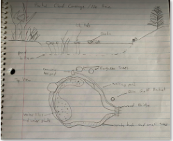
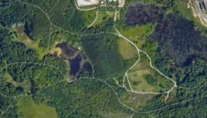
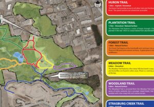
The area that I observed was Edgewater Bar, located in Derby Reach Regional Park in Langley, BC (10 N 527496 5450356). The site includes walking trails, a dog park, picnic tables, and fishing along the Fraser River. I arrived at the site at 12:50 pm on Sunday, April 25th. The weather was overcast with slight rain, and the temperature was 11°C. The study area was approximately 400m2 and consisted of grassland, forest, and the bank of the Fraser River.

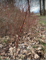
Among the grasses were dandelions randomly distributed throughout the landscape, with blackberry bushes and trees in the background on a slight hill surrounding the park’s perimeter. I noted that the dandelions seemed to have established more abundantly on the flat meadow than the surrounding hills. I wondered how the slope might affect the establishment of the dandelions.

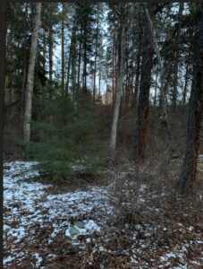
As I made my way along the trail, I observed cherry blossoms in bloom with white flowers amongst other trees, including Sitka Spruce (Picea sitchensis), Grand Fir (Abies grandis), Western Redcedar (Thuja plicata), and Lawson’s Cypress (Chamaecyparis lawsoniana). I spotted two American Robins (Turdus migratorius) foraging for earthworms on the grass, then retreating onto a tree branch once they gobbled up their meal. The Robins did not appear to be phased as people walked by with their dogs. As dogs frequent the area, I wondered how dog barking might affect the courtship behaviour of the robins.

As I travelled northward, I entered the picnic area. The area consisted of grasses and flowering plants, including Creeping Buttercups (Ranunculus repens), Meadow Buttercup (Ranunculus acris), Greater Plantain (Plantago major), and Ribwort Plantain (Plantago lanceolata). Other trees present in the area included Japanese Maple (Acer palmatum), Red-berried Elders (Sambucus racemose), and a Paper Birch (Betula papyrifera) with a Hoof Fungus (Fomes fomentarius) growing on it. I wondered if tree clearing for the picnic area might contribute to the succession of invasive plant species.

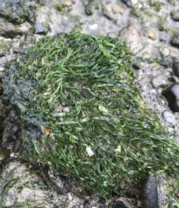
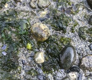
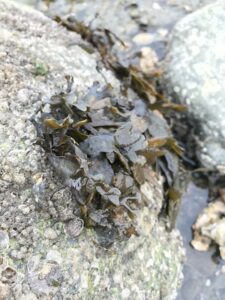
As I approached the Fraser River, I could see filter fabric topped with gravel which capped the natural clay ground of the river bank. There was a fisherman upstream to the right who had just caught a small fish and dogs splashing downstream to the left. Looking back up from the river, I could see grasses growing amongst Western Sword Ferns (Polystichum munitum) and Creeping Snowberries (Symphoricarpos mollis). Throughout the observations, I could hear sounds of birds chirping, dogs barking, and people talking.

Link to images: https://drive.google.com/drive/folders/1q2c8m_LmNkOEtyvapqD9d15cPJy7CUMl?usp=sharing

Reudink, Post 1: Observations

On site: 1600hrs on March 10th, 2021.

Location: Clandeboye road, Manitoba.

Weather/Conditions: -1°c with moderate sunshine, clear skies, and snow on the ground that is actively melting

The chosen study area is the acreage that I live on off of Clandeboye road in the R.M. of St. Andrews, MB. The area is just under 39 square kilometres, as per Google Earth (Figure 1); however, I may restrict the study location to the denser forested areas (Figure 2) depending on the hypothesis I test. The area has a farm yard (no livestock) that still houses two human families and resides in the middle of flat prairies surrounded by agricultural activity in all directions. On the west side of the forested area is a small dike that varies in water volume throughout the year.

Observations:

While walking through forested area, the most abundant coniferous tree species identified was White Spruce (Picea glauca) and the most abundant deciduous tree identified was White Poplar (Populus alba). While walking along the west perimeter of the forested area, I noticed that most of the trees on the periphery were White Poplar (Figure 3). I wonder if this is a more or less desirable location to be in this habitat and if this speaks to the White Poplars’ competitiveness. I wonder if the adjacent dyke has anything to do with this observation.

There appears to be abundant biological activity within the forested area and its perimeter. I encountered an eastern grey squirrel (Sciurus carolinensis), a black-capped chickadee (Poecile atricapillus), a flock of Canadian geese (Branta canadensis). There was also signs of other herbivorous animals, surmised by the different scat dropping I observed. Track marks were present that looked to be from white-tailed deer (Odocoileus virginianus). I found a smaller White Spruce tree with a two-inch diameter oval-shaped hole in its stem (Figure 4) that had a tunnel system that was a two feet long vertically. I wonder what animal did this. They were not currently present. The tree adjacent to to it had several patches of bark ripped off of it as well (Figure 5). Perhaps the bark was taken into the hole to be ripped up and used for insolation. Perhaps the bark ripping is unrelated to the tree hole. Lastly, there are signs of moss and fungal growth at the base of some of the trees (Figure 6). I wonder what kind of ecological implications the moss and fungi facilitates.

Post1_Observations_Figures

Questions:

  1. Are the incidences of White Poplar greater near sources of water?
  2. Which animals are responsible for the hole I found in the White Spruce tree? How old is this hole? Will this hole be re-used by the original inhabitants or will it be taken over by others?
  3. Which type of tree (White Poplar vs. White Spruce) in this area supports more wildlife? What type of wildlife does it support?


Percy Herbet, Post 1: Observations

Location: Duck Pond at the Queen Elizabeth Park Disc Golf Course in Vancouver BC

Date and Time: March 20, 2021 11:30

Weather: Overcast, not raining, ground is quite wet because of the overnight rain, around 10 degrees Celsius

For my project I have selected the duck pond at the disc golf course in Queen Elizabeth park in the heart of Vancouver. Queen Elizabeth is a large city park in the middle of residential Vancouver. The disc golf course is located at the Eastern edge of the park. The final hole of the disc golf course includes a tee shot over one half of the duck pond. The pond and its immediate surrounding area take up a space of around 50 meters by 50 meters. One side of the pond receives high human traffic as there is a walking path that lines the side of the pond for disc golfers to walk from the tee to the basket target. It is also not uncommon for people to wade into the pond on that same side when their discs land in the water. The other side of the pond does not receive the same level of human traffic. scrubby bushes and small trees line this side of the pond. The land surrounding the pond is very flat and covered in moss and grass. A few water lilies and other water plants can be seen surrounding the edge of the pond away from the areas of high human traffic.

Figure 1. Field Notes. Top of page is a side view of the topography of the pond while the bottom half is a top down view of the pond and the surrounding vegetation.

Figure 2. Field notes on vegetation. Rose hip plants appear to be a good study subject.

Figure 3. Field notes on observed birds.

The most notable vegetation includes the scrubby bushes and small deciduous trees lining the pond as well as three large evergreen trees, short moss and grass surrounding the pond area, and water plants in the pond. There were no noticeable signs of mammals in the area but plenty of birds could be seen including seagulls flying overhead, a crow in an evergreen tree, a small finch in the bushes, and mallard ducks, American wigeons, and Bufflehead ducks in the pond. There was also goose feces in the grass surrounding the pond.

The most likely subject targets were the wild roses growing around the edge of the pond. There are many vertical rose plants consisting of one tall shoot with no branching. These plants ranged from under 50 centimeters to well over 2 meters in height. These plants have many buds forming on the upper portions of the shoots. These buds are likely vegetative buds which will form into leaves or branched shoots. Despite the difference in size, the taller rose plants appeared to have a similar number of buds as the shorter plants. The buds on the taller plants were only located on the upper portion of the shoots leaving the bottom portions bare. The linear nature of these plants make them a good candidate for easily collecting fully objective data.

Figure 4. Close up on wild rose plant buds.

Figure 5. Dead rose hips from the previous year still attached to the plant.

Based off of my initial observations the three study ideas that I have come up with are:

  1. What impact does the level of human traffic have on the species and density of grass and moss?
  2. What impact does water plant density have on the water fowl distribution on the pond?
  3. Is there a correlation between height of wild rose plants and the number of buds forming? Is there an optimal distance range from the tip of the shoot for the buds to form regardless of plant height?

Post 1: Observations

Date: Feb 28, 2021 (Winter)
Time: 1400
Location: Seymour River/Maplewood Creek Park
Topography: northern cliff is approximately 60 degree slope down to the river, artificially-placed rocks along slope and river bank. Southern slope (park-side) is around 45 degrees with similar rocks like the northern slope.
Weather conditions: Cloudy, slight breeze, approximately 5 degrees Celsius.
Vegetation: forested with native and ornamental trees/shrubs, different species of moss along river bank and upper slope.

Questions:
1. What different types of mosses exist on both sides of the river, where do they grow, and what populations do they support?
2. There is a large growth of invasive Japanese Knotweed on the northern, upper slope of the riverbank. What is currently being done about the species and how has the plant/treatment affected the local ecosystem?
3. What kinds of animals use the park, and what factors attract them to the park?

Blog Post 1: Observations

On site: 17:00 hours, February 17th 2021

Location: Mission Creek Regional Park

Weather/conditions: 3°c southern winds, light dusting of recent snowfall, late winter conditions with the sun nearly set.

The chosen study area is approximately five square kilometers (paced) within Mission Creek Regional Park in Kelowna, BC. Located west of the Springfield road park entrance, and on the south side of the creek. The area spans north to south from the creek bank to the apex of the upland north-facing slope, crossing a dyke/trail and forested flood plain. The area is bordered by walking trails on the east and west sides. Historically, Mission Creek was narrowed to protect the city and the dykes are now a popular walking path.

Observations:

The creek flows east to west/southwest, and is mostly frozen on the surface after the recent cold snap. Only small pockets of flow remain visible. The creek bank is comprised of riprap leading to a shrub and small deciduous tree riparian zone, meeting with the dyke built parallel to the creek.

The area descends back to creek elevation (several meters) into a forested flood plain/depression zone to the south. This flood plain contains diverse layered vegetation, with dominant shrubs identified as Oregon Grape (Malonia aquifolium) and Common Snowberry (Symphoricarpos albus). The tree population was fascinating, with such a variety of mature growth; Ponderosa pine, Birch, Douglas Maple, Poplar, Alder were identified. A few young evergreens were spotted growing in the midst. Decaying logs and leaves of several species were noted on the forest floor. Transitioning further south into the uplands, the vegetation thins into that of a dry forest consisting of Ponderosa Pine and Grass at the slope apex.

Figure 1: Flood plain looking south towards uplands. (Loverin, 2021)

Questions:

  1.  Is the concentration of deciduous trees in the flood plain related to the creek proximity? or the natural depression of the area?
  2.  Are there fewer Ponderosa Pine closer to the creek? possibly more competition or less favorable conditions?
  3. Does the human disturbance in the area impact the growth and dispersal of the common snowberry (Symphoricarpos albus)?

Field notes – blog post 1

References:

Loverin, K. (2021). Flood plain looking south towards uplands. [photograph].

Parish R., Coupe R., Lloyd D. (1996). Plants of Southern Interior British Columbia. Lone Pine Publishing.

Post 1: Observations

January 8, 21
3-4pm
Sunny
-7 degrees Celsius

Initial Field Observations at Huron Natural Park – Meadow Trail

Huron Natural Park is a park located in Kitchener, Ontario. Within the Park, the Meadow Trail is the trail which I am choosing to observe. This trail is 0.6km in length. It is quite hilly, but is a relatively easy trail. Either side of the trail is forest, with a combination of deciduous and coniferous trees, though the trees are mostly deciduous along this trail. As it is winter, this means the forest is mostly bare. I chose this trail as it is one of my favourites at this park. The path itself is almost a clearing as it is quite wide. This trail is known for having a large number of bird species. At the top of the hill along this trail, there is a clearing with a bench. There are also two bird feeders located in this clearing area at the top of the hill. On my initial trip to the trail, I observed a blue jay, a brown creeper, and a red-breasted nuthatch along this trail.

The three questions which my observations made me consider were:

  • Are bird species more prevalent at the feeders? This area does have benches for people as well, so I am unsure how popular these feeders may be.
  • As partial-migrants, can I expect to see any red-tailed hawks at the clearing of this trail? They are known to occupy this area in warmer weather.
  • As the park is far less busty due to covid-19 restrictions, can I expect to find more species here than can usually be found?

Post 1: Observations (Vancouver, Beach)

I have chosen a section of beach just north of Volunteer Park, in Kitsilano, Vancouver.

(49.2720355, -123.1693128)

Observations

General landscape

My first field observation took place on Friday, 12 February, from 12:17 to 13:06. The weather was cold (approx. -2 degrees Celsius) and overcast. According to Fisheries and Oceans Canada (tides.gc.ca), the predicted low tide was at 12:38 and was 3m (relatively high, the next low tide at 23:50 is predicted to be 0.6m).

IMG_5661

Figure 1. The beach north of Volunteer Park seen from the edge of the water at low tide, 12 February 2021. A. The entrance to the steps down to the beach. B. Hill slope, with some vegetation (mostly grass and ivy). The slope extends 2-3m, with an elevation drop of 4m. C. Big rocks and logs, extends 2-3m, 1m drop. D. Sandy beach, extends 4m, 1m drop. E. Intertidal zone, 14m to edge of water, less than 1m elevation drop. All measurements are visual estimates.

The selected site (Fig. 1) is the tidal area of the beach found down the steps from Volunteer Park.

Vegetation

On the hill there is trees, some grass, and (especially around the tree, close to the concrete wall to the east) some ivy. I saw minimal land vegetation past the large rocks.

I saw a few different kinds of seaweed, some more clearly different than others (Figure 2). They looked different but I will have to spend more time looking at the seaweed at the beach with an identification guide in order to know. The only seaweed that was further up on the beach was the reddish-brown “finger-leaf” seaweed.

Figure 2. Photographs of seaweed found at the beach site. First to last: “mossy” green seaweed, “kind-of-mossy-but-with-longer-strands” green seaweed, “slimy-sheet” green seaweed, “finger-leaf” greenish-brown red seaweed, “fuzzy” red seaweed, “finger-leaf” reddish-brown seaweed.  

Animals

From the big rocks down through to the edge of the water, I found many shells both whole and in fragments. I could identify lots of mussel and oyster shells, and fewer clam shells. (Fig. 3) Living examples of all of those were in the wet intertidal zone. (Fig. 4) Towards the bottom of the sandy beach, very little sand was visible because of the amount of small pieces of shell.

IMG_5664

Figure 3. Shells found on the sandy beach. A. Oyster shell. B. Mussel shell. C. Broken clam shell.

IMG_5674

IMG_5675

Figure 4. Top: Mussel attached to rock. The hairs of the “beard” are visibly connecting the animal to the rock. Bottom: Oyster in a shallow pool, covered in barnacles. 

I also spotted evidence of buried animals. I found holes in the mud of varying size (Fig. 5), saw a couple spurts of water (as some clams do), and what looked like the open razor-edges of buried mussels (Fig. 6).

IMG_5680

Figure 5. Small holes in the mud in the intertidal zone.

IMG_5691

Figure 6. Open shells of bivalves, underwater. 

Barnacles were visible on most hard surfaces in the intertidal zone, including rocks and other animals (Fig. 4 bottom). I did not witness any barnacles open to catch food.

The most prevalent birds were crows, with some seagulls mostly flying overhead, and a few Barrow’s goldeneye ducks swimming near the water’s edge. The crows appeared to be digging in the intertidal mud, and varied in group size from individuals to large groups (Fig. 7). They were often quite noisy.

IMG_5682

Figure 7. Crows in the intertidal zone.

Surprisingly for me, considering the cold weather, I also saw some small flying insects walking on some of the rocks (Fig. 8). They moved quickly.

IMG_5688

Figure 8. Small winged insects, seen moving on rocks in the intertidal zone. Three individuals are circled in red. 

I did not see any sea stars, anemones, or jellyfish, all of which I have seen before at low tide on beaches in Vancouver. It is possible this absence is because the low tide at the time was not very low, but also I have not looked closely at this beach before and they may only be present elsewhere.

People

This beach is located in between Kitsilano beach and Jericho beach, and when the water is not too high, it is a popular spot for taking a walk. While I was there, many people walked past. Some people were just out for a walk, but many also had dogs. Most of the dogs were unleashed, and often ran in the intertidal zone. I especially noticed dogs occasionally chasing the crows.

Note about identifications:

Any animals identified above are not listed with the Latin binomial names because I did not consult a guidebook, so the identifications are just from my own previous knowledge, to the best of my ability, and may not be exact or fully accurate. In my next field observations, I hope to be more specific as I narrow the focus of the field study.

IMG_5710

IMG_5711

IMG_5712

Potential Research Questions

  1. How do the species of animal vary from the upper- to the lower-intertidal zone? Are some species or animal types restricted to one section of the intertidal zone? Is there variation between individuals (eg. size) of a species as they get closer or further from the top of the intertidal zone?
  2. What are the different species of seaweed present in this area? Do they vary in distribution? Are some seaweed species often close to particular animals?
  3. What is the effect of people on the activity in the intertidal zone? Does the presence of unleashed dogs reduce the number of birds?

Post 1: Observations

Initial Field Observations

Date: January 12, 2021           Time: 2:00pm – 2:30 pm                     Temperature: 0°C

Weather: overcast                   Location: yard around my house        Season: Winter

Side view of initial observation area
Aerial view of initial observation area

The yard is approximately 2.5 acres of flat grassland with a few trees along one edge and neighbors and a road on the others. The treed edge is the edge of a cliff leading down to a riparian area along a creek in the valley below. There is a beaver dam built in the creek below the house. Across the road is a mountain slope up to a plateau. The area is agricultural with most of the surrounding properties having various types of livestock.

The entire yard is covered in snow. No fresh snow for the past few days and snow on the ground has a hard crust. Minimal vegetation visible. Front yard has one large willow tree and a small lilac bush. The back yard has a large Blue Spruce, a small stand of Aspen on the cliff edge, and a small maple tree. Dormant Saskatoon bushes between the road and property edge. No dead grasses visible due to depth of snow. A few cones visible under the Blue Spruce in the back yard. No animals were observed during this observation session. No tracks, scat or evidence of any animals seen.

When examining the willow tree, many rows of fairly uniformly sized and spaced holes were discovered in the bark. Three small mushrooms were also observed to be growing on the willow but I was unable to tell if they were currently alive. An old bird’s nest was also seen in the branches of the willow. Bark damage to one of the aspen trees on the cliff edge was noted and photographed. The bark of the aspen trees was also noted to be green on some sides of some trees.

Holes in willow tree

Three questions that could be investigated further:

1) Holes in the willow tree: What made them? How can they make them so uniform? Why?

2) Green aspen bark: Why is it green? Why isn’t every tree green? Why only on some sides of the tree?

3) Mushrooms on the willow: Are they alive in the winter? If so, how can they stay alive in winter conditions?

Blog Post 1: Observations

My study area is about 10 by 10 metres just off of Tannis Way in Nanaimo. The area has three main sections: 

  1. A meadow of exposed conglomerate rock covered by a thin layer of moss and a few small plants that can survive on so little sediment. It also has a footpath where regular human activity has caused vegetation to not grow. This section is on a slant and doesn’t retain water well so the water runs down into muddy pools.
  2. Muddy pools that retain lots of moisture and have collected sediment. These areas are mostly covered in a thick layer of sedge (possibly Carex stylosa but it’s hard to tell since it’s winter) and have few other forms of vegetation.
  3. The last section is under tree cover and has much more diverse vegetation. The trees include Arbutus trees (Arbutus menziesii) and short Douglas firs (Pseudotsuga menziesii).  Underneath the trees is a thick layer of moss, small shrubs like salal (Gaultheria shallon), and low growing plants. Dead trees had lichen and mushrooms growing on them. It is interesting to note that there are no Western Red cedars (Thuja plicata) and the salal is very sparse which is unusual for this area.

This is an Environmentally Protected Area designated by the City of Nanaimo. I visited my study area for the first time on January 21, 2021, at 1611 hours. It is currently winter and that day it was 5°C with a slight breeze and a clear sky.

Some possible questions for my research project: How do the differences in types of moss and thickness of moss affect animal diversity? How do the geographical differences affect plant diversity? What is causing the number of cedars and salal to be less than average?

Photo of the research area and some identified vegetation: https://photos.app.goo.gl/ASLsfzXSEjLjA3RE8

All vegetation was identified using:

MacKinnon, A., & Pojar, J. (1994). Plants of Coastal British Columbia including Washington, Oregon and Alaska. Lone Pine Publishing.

Blog Post 1: Observations

Saturday, Nov 7th     Time 2:30pm       Temp: -20C      Weather: Windy with cloud cover

I have selected Kenna Cartwright park as the site for the field project. This 800 Ha city park is located close to large shopping areas and transportation facilities in Kamloops. It is a mountainous and forested area with a variety of vegetation like the Ponderosa pine and Douglas fir, as well as some deciduous trees and shrubs. I walked 1500m along the path present in the park and observed the following:

  • Trees of similar maturity appear to grow close together; there is little observed heterogeneity in the maturity of the trees close to each other. I would want to study the relationship between the distancing of the clusters of trees and the probability of new tree growth.
  • The area above the path leading to the top of the hill has more evergreen trees while the bottom part of the hill has more deciduous shrubs. I would like to determine whether there is an observable difference in the composition of the soil between these two parts of the hill, which would affect the distribution of the trees.
  • The tree distribution varies with the distance from the entrance point. Considering that this park is close to high traffic and a developed area, I would want to study the relationship between the density of the trees and the distance from the entrance to the park, which is generally more accessible to disturbance factors

Images for Blog post 1

Instructor: Robyn Reudink