Blog Post 1: Observations

The location I have chosen to observe over the period of this course is very close to home (literally). I live in rural Ontario on my family farm. The 100 acre farm is situated in the town of Kincardine. Historically, home to dairy, poultry and beef cattle, but now primarily functions for cash crops. The property is partially forested with tributary creeks from the Penetangore River in the northerly portion of the property (Figure 1).


Figure 1: Shelton Family Farm Property (Lot 20, Concession 5)

The primary focus of this project will be the pond in the south easterly portion of the property (Figure 2). This pond was man made approximately 30 years ago. It has an approximate perimeter of 94.32 meters and surface area of 527.82 m2 (Figure 3). The depth of the pond is about 6 meters. Although a smaller study area then what has been chosen by other students in this course it is thriving with biodiversity. The pond goes through many changes from season to season, and evidently has become increasingly vegetated and overgrown in the last 5 years. (To be discussed in a later post with comparative air photos and hypothesis).


Figure 2: 2015 Air Photo of the Shelton Pond


Figure 3: Approximate Pond Measurements

In my childhood, as well as my mom and her siblings’ kids have spent numerous hours catching frogs, tadpoles, toads, salamanders, fish, and observing various birds and snakes thrive in this ecosystem. A variety of animal tracks indicate that it is frequently visited by deer, coyotes and racoons as well. I am keen to take the time to identify these species. My initial questions for this research project are as follows,

1. How many varying species of plants can I identify? Are there any invasive species? Which species are more rare than others?
2. How will the upcoming weather changes (fall to winter) effect the vegetation and functionality of the pond ecosystem?
3. How have reduced water levels (compared to Spring and Summer) effected vegetation and species? (Figure 6).
4. Do any endangered or species at risk live in or utilize this ecosystem?

These observations and photos were taken October 6, 2019 at noon. The temperature was approximately 15 degrees celsius, partially cloudy and windy.


Figure 4: Side Profile of the Pond


Figure 5: Close Up View of Pond


Figure 6: Reduced Water Levels in Pond


Figure 7: Mammals den or did my dog dig this hole?

Blog Post 1: Observations

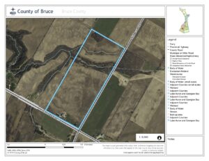
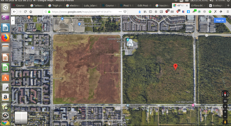
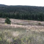
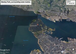
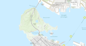
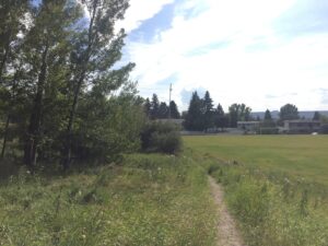
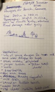
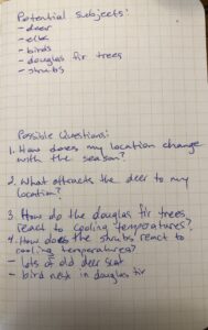
The site that I selected was the peat-lands in the DND Lands in Richmond, BC, between No. 4 Road, Shell Road, and the Westminster Highway. The coordinates for my initial observation point were 49°10’24.8″N 123°06’21.2″W, and my first observations were conducted at 12:15PM, on Sunday 29th of 2019. This particular portion of peat-land does not have an official geographical name; however, it has historically been considered a part of the greater Lulu Island Bog.

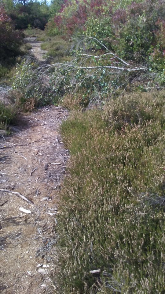
While visiting, the weather was sunny, and 16C. The terrain appears, for all intents and purposes, to be flat, although most peat bogs are known for being either domed, or gently undulating. The particular area that I first explored showed signs of having been subjected to fire in the passed few years. This observation is in line with what I would have expected; in July of last year, I observed the first signs of what was most likely the fire that caused the damage I was currently observing, while I worked at Kwantlen Polytechnic University’s Garden City Land’s farm in 2018, which is located on the parcel of land just west of the DND lands (west of Number 4 Road).

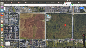
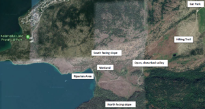
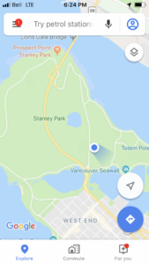
(Aerial view of the DND Lands, inbetween the Garden City Lands, and the Richmond Nature Park. Google Maps.)

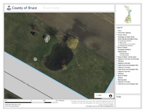
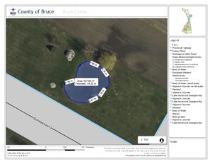
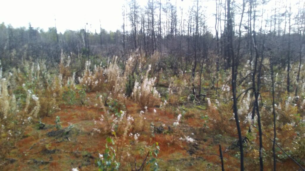
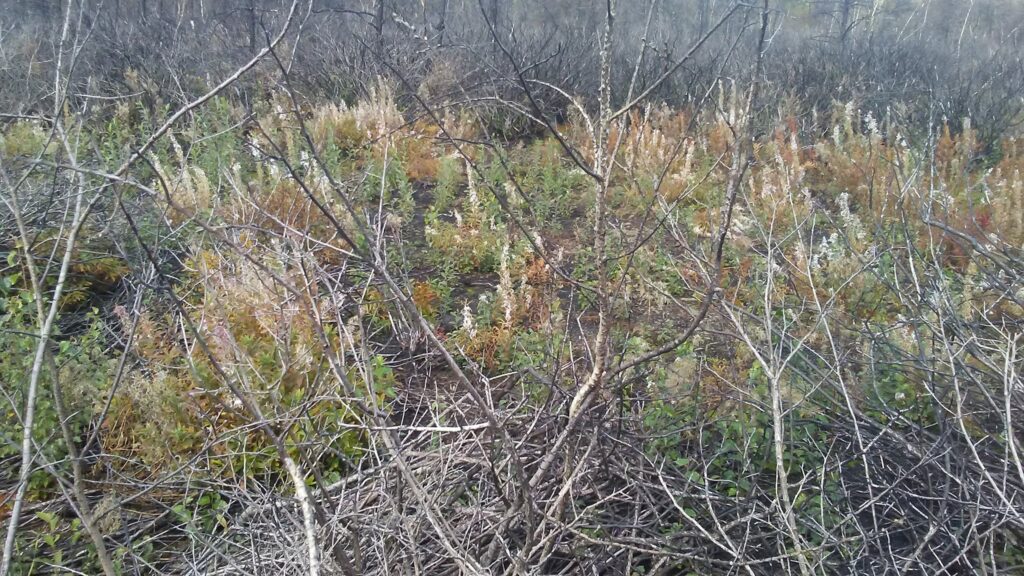
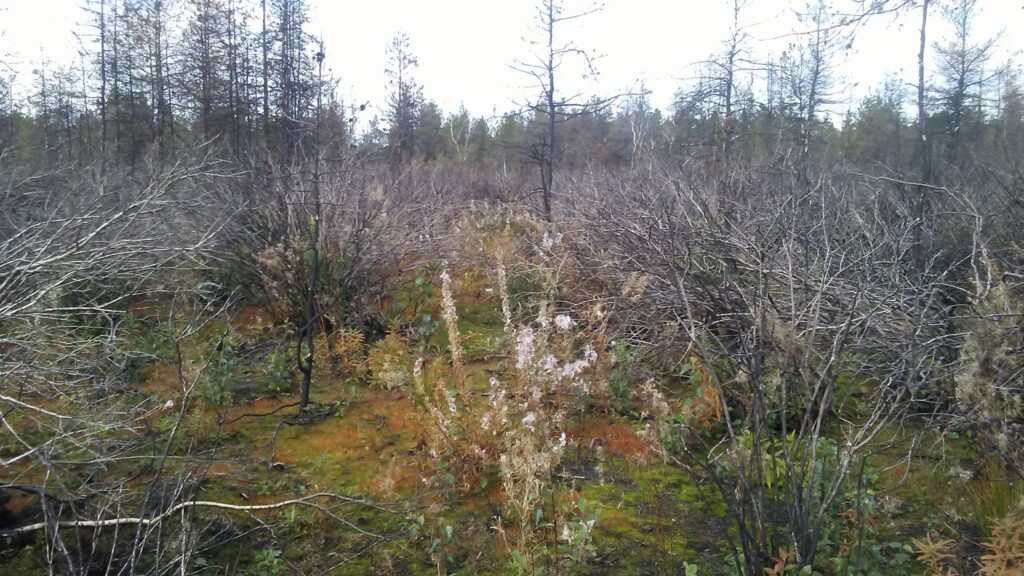
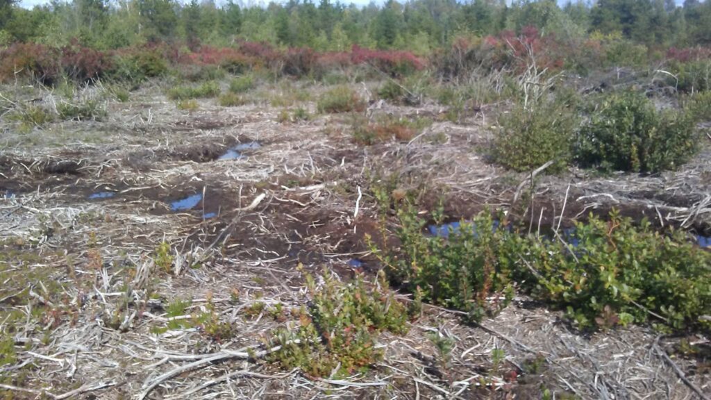
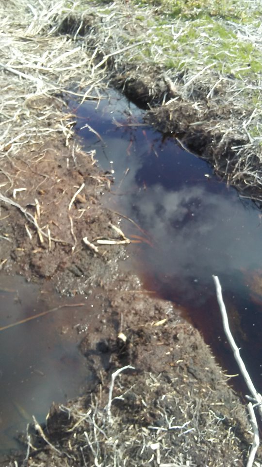
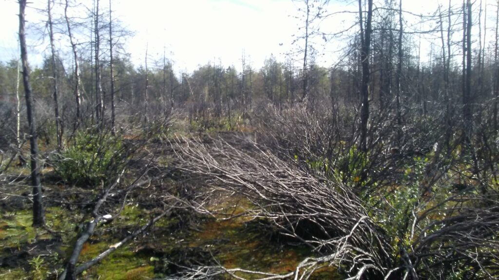
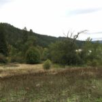
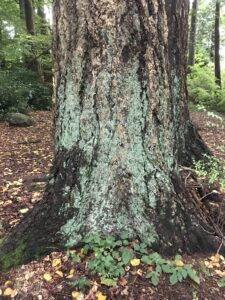
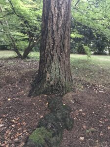
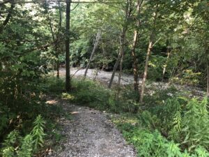
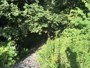
(Above images: Images of burnt over areas observed at initial observation site.)


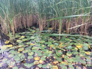
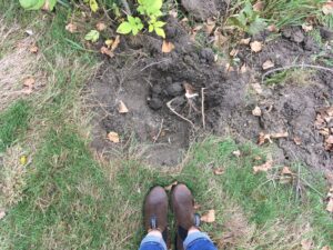
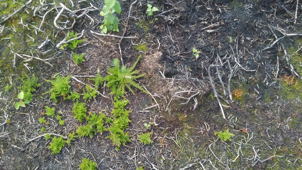
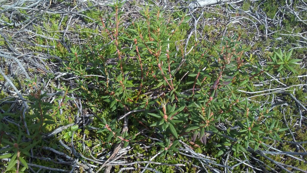
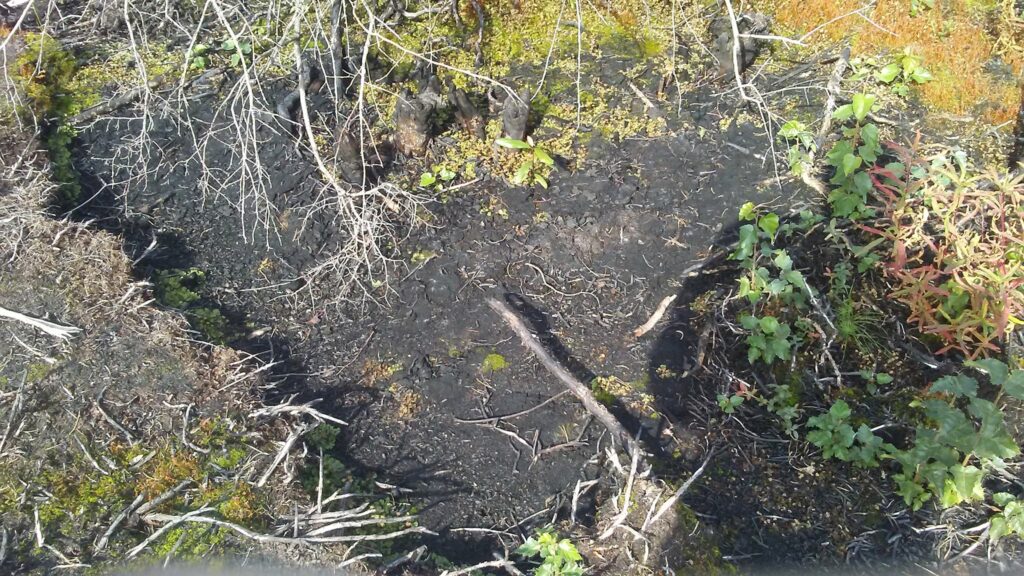
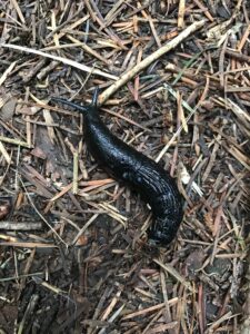
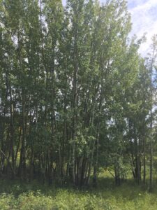
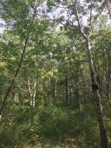
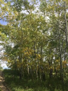
What struck me about this particular peat-land, besides the blackened Vaccinium spp. shrubs, and shore pines (Pinus contorta var. contorta) (1), was the abundance of invasive Scotch heather, Calluna vulgaris (2), which was regenerating vigorously after only a year since the bog fire took place, along with the proliferation of the seedlings of another alien invasive species, the European birch, or Betula pendula (3). In many places it appeared as if the two species were the primary pioneer species on burnt and exposed sphagnum based peat soils. It also looked as if a lot of the primary fuel for burning may have come from a dense under-story of low shrubs, because the trees and Vaccinium spp. were burnt from the bottom upwards. In a few spots I did notice black pits surrounding larger trees and shrubs that had died from burning, and I suspect that this is where subterranean peat fires may have followed dead roots to the surface, where they may have broke out, and ignited surface fires amongst what appears may have been dense, fine branched, low growing, woody vegetation, most likely Ericacious.

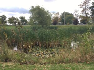
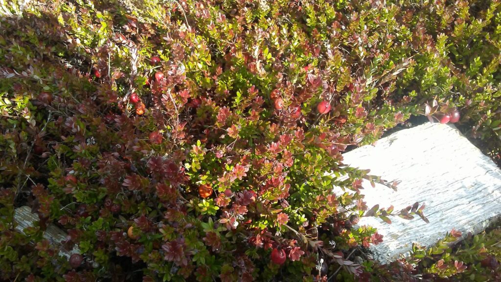
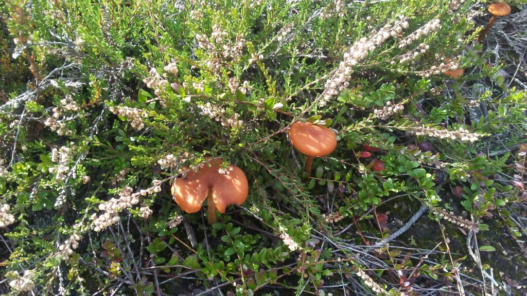
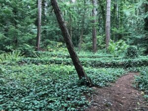
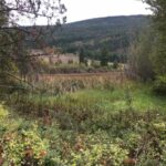
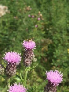
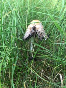
(Above images: Images of vegetation within the bog, clockwise from left to right; Vaccinium spp., cranberry, have yet to confirm the species, young Scotch heather, Calluna vulgaris, colonizing fire effected area, mature C. vulgaris growing with an unknown fungus, northern Labrador tea, Rhododendron tomentosum (4), growing in a cut over firebreak close to burned area, mature C. vulgaris growing beside a trail in part of the bog that was not effected by the fire, and a C. vulgaris seedling growing in the wheel-track of what I’m assuming was a firetruck.)

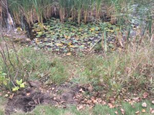
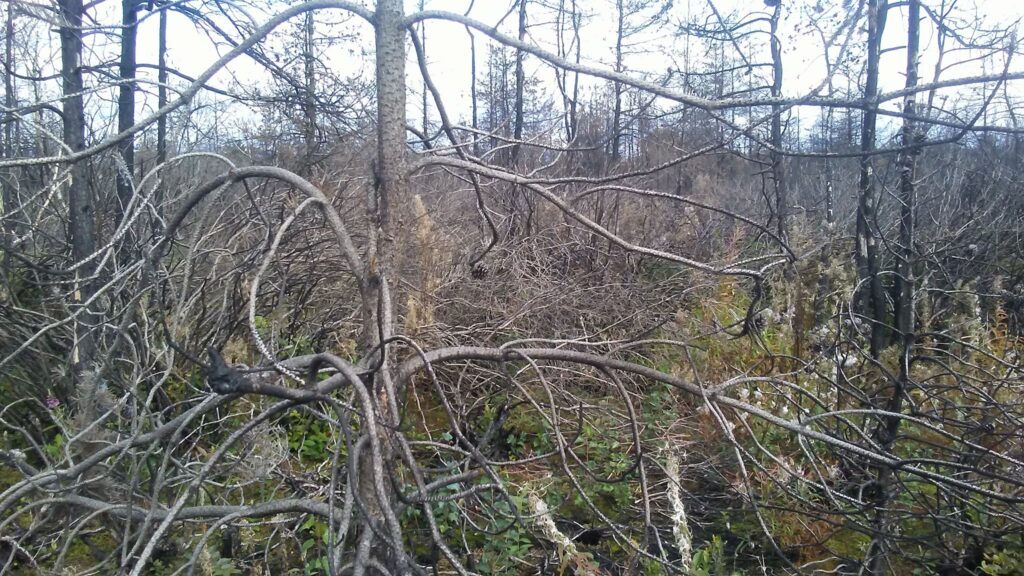
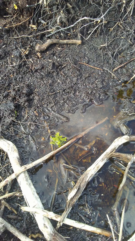
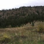
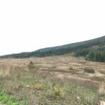
(Above images: images of effects of fire on the bog, as well as what I suspect are most likely tire tracks left by firefighting vehicles. The second images over from the left is of particular interest, because this may be one of the spots where subterranean fire followed a root to the surface, where it likely ignited surface fires.)

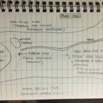
Of interest to me, about this site, is the fact that it contains some of the last Lulu Island bog-lands; also, the fact that I am able to now observe the state of the bog a year after the bog-fire I had previously observed in 2018; and, lastly, the fact that the bog is most likely experiencing changes in floral composition due to the introduction of two new European species.

For these reasons, I would like to explore a few interrelated questions:

1) Has the introduction of C. vulgaris led to an increased build up in flammable material in this area?

2) Is the bog being artificially drained, and what effect, if any, is this having on C. vulgaris populations, and the native vegetation?

3) How does C. vulgaris respond to fire?

4) How does the native bog vegetation respond to fire?

The first two questions may be more difficult to ascertain answers to. However, I might be able to deduce hypothetical answers from forensic observations of dead and burned vegetation for question one. Question two may require doing research or conducting interviews with civil engineers in Richmond. The last two questions, on the other hand, may indeed provide testable questions that could provide the basis for an experimental design that focuses on the comparison of alien versus native pioneer species fitness in different locations with variations in the degree of fire damage.

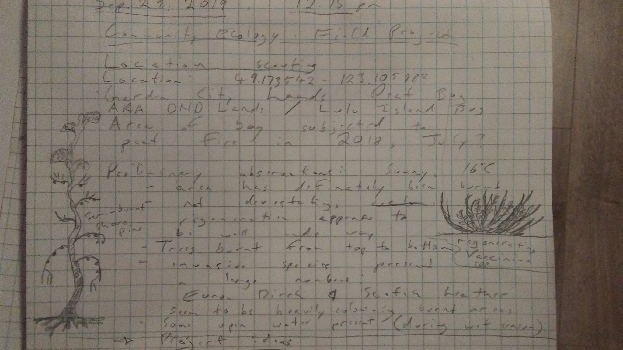
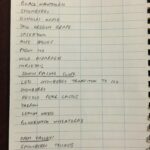
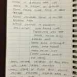
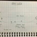
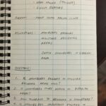
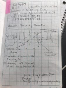
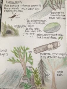
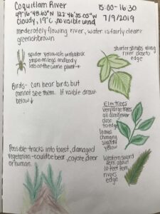
(Above image: field notes of my observations for Sep. 29, at Lulu Island Bog/ DND Lands.)

Citations:

1-4 In Klinkenberg, Brian. (Editor) 2019. E-Flora BC: Electronic Atlas of the Plants of British Columbia [eflora.bc.ca]. Lab for Advanced Spatial Analysis, Department of Geography, University of British Columbia, Vancouver. [Accessed: 02/10/2019 9:14:33 PM

Blog Post 1: Observations

Initial observations:

The area I have chosen to observe is a small forest area in North Saanich, B.C. There is a trail that connects two suburban roads and a covered forest area to the right of it. I visited the site on September 21. 2019 at approximately 12:10pm. The temperature outside was 16 degrees C with complete cloud cover and no sign of recent rain. The northern side (I believe I will double check coordinates on my next visit) of the trail begins off of a suburban road and the entrance is covered by trees but while walking opens up with the forest on one side and a small area of farm land on the other. The trail opens on the southern side at another suburban road. I noticed while walking that the soil and vegetation that grows changes greatly this is most likely due to the trees that cover the beginning of the trail. The vegetation on the north side of the trail was low to the ground and dense while the vegetation on the south side of the trail was more grass-like and drier with the ground and soil being dry as well.

When entering the forest area I noted a “wildlife tree” with a sign labelling it as such. This tree had a very different appearance to the trees around it. The bark had been worn away, it was much shorter, and it had small holes all over it (from birds and insects? unsure of what type). In the forest area I noted two black slugs (most likely Arion ater L.) and one yellow spotted slug (most likely Ariolimax columbianus). I also noticed that most of the forest floor was covered in a vine-like plant, as well as some going up a few of the tree trunks, covering some smaller tree stumps that had been either cut down or fallen over and completely covering two fallen trees. I was curious as to the plants preference for where it grows- if it has a preference for dead vs alive trees. A few mosquitos were also noted!

some initial questions from my visit are:

  1. why was the “wildlife tree” showing signs of animals/insect preference when no other trees around had similar markings? what caused this? also interesting to note this tree was at the very beginning of the trail and visible from the road side- why would animals have a preference for a tree closer to human habitats.
  2. How does branch cover affect the soil and the vegetation that grows there? how light exposure affects plant growth.
  3. The pattern of the growth of the vine vegetation was of interest to me and I am curious if the conditions to which the plant is growing affects it, is it getting nutrients from the decomposing trees? I will see if I can find roots without harming the vegetation.  

Blog Post 1: Observations

The location I have selected for my field research project is Cosens Bay in Kalamalka Lake Provincial Park, Vernon BC (50011’44” N, 1190 15’40” W) (Figure 1). There is a hiking trail that extends approximately 2.5 km from the car park west, downslope towards Kalamalka Lake. On September 25, 2019 between 17:20 and 18:45 it was 15 degrees Celsius and cloudy. Several ecological communities are present (including forest, grassland and riparian communities) within the Cosens Bay area, of which are associated with the following features: the riparian area of Kalamalka Lake, adjacent wetland, open disturbed grassland, gulley features, south facing slope with an open canopy and a north facing slope. Given the environmental gradient at the site there are several differences in ecological communities to observe.

Figure 1. View of Cosens Bay Hiking Trail and different ecological communities.

The riparian area of Kalamalka Lake (approximately 400 m above sea level (asl)) consists of a vegetated area approximately 20 m wide and 330 m long with black cottonwood (Populus trichocarpa), interior Douglas fir (Pseudotsuga menziesii) and a stand of trembling Aspen (Populus tremuloides) trees (Photo 1). Several dead black cottonwood trees are wildlife trees with cavities suitable for nesting avian species. Shrub species along the riparian area consist of black hawthorn (Crataegus douglasii), common snowberry (Symphoricarpos albus), Douglas maple (Acer glabrum), tall Oregon grape (Mahonia aquifolium), Saskatoon (Amelanchier alnifolia), rose species (Rosa spp.), poison ivy (Toxicodendron radicans), wild asparagus (Asparagus officinalis) and horsetail species (Equisetum spp.).

Photo 1. View looking south west towards Kalamalka Lake illustrating the vegetated riparian area.

Behind the black cottonwood riparian band is a wetland feature approximately 75 m wide and 170 m long (at similar elevation of 400 m asl) with common cattail (Typha latifolia) dominating the wetted perimeter of the wetland (Photo 2). Other shrub species surrounding the wetland include the aforementioned species.

Photo 2. View looking south east towards wetland feature and area of common cattails.

North of the riparian area is a south facing slope extending up to 700 m asl dominated by ponderosa pine (Pinus ponderosa) with some interior Douglas fir trees (Photo 3). The tree canopy is relatively sparse as the elevation increases to 700 m asl with an understorey dominated by bluebunch wheatgrass (Pseudoroegneria spicata). Areas of exposed rock are present indicating shallow soils.

Photo 3. View looking north illustrating the south facing slope, exposed rock and open canopy.

An open valley is between the south facing slope, and a north facing slope. The open valley appears disturbed with a high occurrence of invasive species including knapweed species (Centaurea), mullein (Verbascum thapsus), thistle species (Cirsium spp.), sulfur cinquefoil (Potentilla recta), white sweet clover (Melilotus albus) and chicory species (Cichorium spp.) (Photo 4). Native species within the open valley included thickets of common snowberry and Saskatoon. The north facing slope is more gradual relative to the south facing slope and consists of a dense interior Douglas fir forest (Photo 5).

Photo 4. View looking east illustrating the open, disturbed valley with shrub thickets.
Photo 5. View looking south towards the north facing slope dominated by interior Douglas fir trees.

Wildlife observed within the riparian area included birds of prey. A chorus frog was heard adjacent to the wetland area and signs of deer were observed within the open valley. No other wildlife was observed, however the area would likely be used by other song birds and ungulate species.

On review of the different ecological communities, I observed more common snowberry present in the riparian area, surrounding wetland area, and moisture receiving areas within the open valley community. Common snowberry was less dense when the ecological community transitioned to a steeper, south facing slope. In areas where rock was exposed and the understorey was dominated by bluebunch wheatgrass there was little to no common snowberry present.

On review of the ecological communities, the following questions are presented:

  1. Is common snowberry present in moisture receiving areas only?
  2. Is common snowberry more dense in riparian areas?
  3. How drought tolerant is common snowberry?
  4. Is common snowberry important foliage for wildlife in fall and winter?
  5. Does the presence of common snowberry influence the occurrence of wildlife in fall and winter?
  6. Can understanding common snowberry and associated species influence riparian restoration and enhancement to improve water quality and overall watershed management?
  7. Is the riparian area ecological community Red or Blue listed in BC and how does this influence management decisions?

Field notes from September 25, 2019 are attached below.


Preliminary Observations and Interests in Stanley Park

The location I have chosen to study is Stanley Park, in Vancouver. Stanley Park is an urban public park that covers 404.9 hectares, located in the lower mainland region of British Columbia. The park is situated between downtown Vancouver (south), and the ocean water of Burrard Inlet and English Bay (north, east, and west; Photo 1).

Photo 1. Aerial image of Stanley Park (Image retrieved from Google Earth Pro)

The elevation ranges from sea level to 76 m throughout the park (Photo 2). Prospect point located in the northern part of the park, is the topographic peak of the park. The vegetation within Stanley Park consists primarily of forest (conifers and deciduous). The Vancouver city park is located on Federal land that is leased  to the City of Vancouver, and was established in 1888 by Lord Stanley.

Photo 2. Topographical base mapping of Stanley Park (Image retrieved from from iMap BC).

On 24 September 2019 I observed a small area of the forest (100m line of trees North to South; Photo 3 – 5) in the southeastern corner of the Park (Photo 6). I visited from 18:23 to 19:00, before sunset (19:05). The weather and general site conditions consisted of low light, light wind, and 14°C.

Photo 3. Base of Douglas fir (Pseudotsuga menziesii) with visible dust lichen (Lepraria species) and moss (unidentified)
Photo 4. Base of Douglas fir (Pseudotsuga menziesii) showing multiple types of unidentified moss and lichen on exposed root bark.
Photo 5. Field notes 24 September 2019 describing general forest observations


Photo 6. Approximate location of observation for Module 1 Observations (Image retrieved from Google Maps)


Potential subjects of study:

  • Trees (ie. coniferous and/or deciduous)
  • Mosses
  • Lichens

Potential research questions:

  1. What physical conditions in Stanley Park favour the growth of lichen and/or moss on trees?
  2. Is there a pattern of distribution of lichen and/or moss species across Stanley Park?
  3. Does lichen and/or moss grow on all tree species in the Stanley Park?

Sources:

B.C. Conservation Data Centre: CDC iMap [web application]. 2019. Victoria, British Columbia, Canada. Available: http://maps.gov.bc.ca/ess/sv/cdc/ (24 September 2019).

Google. (n.d.). Stanley Park. Retrieved from: https://www.google.com/maps/place/Stanley+Park/@49.3064903,-123.1521274,14.38z/data=!4m5!3m4!1s0x5486718cad26e4a3:0x364a639db409e216!8m2!3d49.3042584!4d-123.1442522

Post 1 – Observations

Blog Post 1 – Observations

The location I have chosen to study is along Coquitlam River Trail on the Port Coquitlam side. It is a large area spanning many kilometres, but I have chosen a plot of about 75m X 75m. Weather was cloudy, 19 degrees with no visible wind. Area was visited on September 7th 2019 at 15:00-16:30. It features a large river, flowing moderately with clear greenish brown water. In the river is a small rock dam, most likely built by humans. In this area there is less water flow and about 15 bugs are present on the waters surface.  Lining the river are large elm trees and shorter plants with large and flat green leaves. These shorter plants host many spiders in their webs. Western sword fern are approximately 4-5 metres from the rivers edge on a higher bank. Pine and maple trees are in the same area, and are more present further back into the forest. Trees with flat branches and soft needles are present as well – possibly hemlock. One log on the rivers edge is covered in Oyster mushrooms, including one large one about 20cm long. No other logs nearby have these mushrooms present. There are a few small paths going into the forest with trampled vegetation, possibly from humans, dogs, bear, coyote or deer. Birds can be heard but not seen.

Questions arising from this observation:

Why are the Oyster mushrooms only on this one log?

Why are most of the Elm trees leaning towards the river?

I noticed that the larger trees are beginning to change colour, but the shorter shrubs and younger elm are not. Is there a reason for this?

The river bed contains sand and large rocks, but nothing in between. Why are there no smaller stones present? And why do only the rocks on shore have moss, not ones that are partially in the river?

Why are there no maple trees near the rivers edge?

Do only certain plants survive near the rivers edge?


BLOG POST 1

I am studying the “Bee Garden” that is located on the Thompson Rivers University campus in Kamloops beside the Ken Lepin building. It is a small garden with a variety of plants that are supposed to attract bees/ pollinators. There are a few benches that are near and two sets of stairs where people walk by. The first day that I visited the Bee Garden was June 2nd, 2019. That Sunday was relatively warm, within the twenties, and it was mid-day.

The three questions I have thought about are:

How many bees go to each plant?

Does the colour of the plant attract bees more? Or does the symmetry of the plant? (symmetry vs colour)

Does the change in weather seem to affect how many pollinators are out and about?

After going to talk to Dr. Lyn Baldwin about my hypothesis, and my questions, I decided to change my questions. Lyn suggested looking at the weather or the time of day, and then counting the number of pollinators. Therefore, my new questions would have to be:

Does weather seem to affect how many pollinators are out and about?

Does the temperature affect how many pollinators are out and about?

Does the time of day seem to change how many pollinators are out and about?

new doc 2019-09-17 20.02.36

Attached are pictures of the Bee Garden that I was studying and the other page was some species that I noted and found some information about.

Blog Post 1: Observations of Whispering Woods

I have chosen to observe a small deciduous forest, approximately 150 square metres in size, located at 51°6’14”N and 114°8’21”W, just outside of the NW Calgary Dr. EW Coffin Elementary School limits. This city park was adopted by the elementary school through the Adopt-A-Park program, but otherwise holds no designation. I visited this site on September 16, 2019 from 3:15pm to 3:50pm. The weather was 16°C and mainly sunny with some cirrus clouds.

Coordinates of Whispering Woods on informational sign
Large, green aspen trees on South face bottom of hill

The forest is located on a hillside, with the elevation gain of about 12m, from an altitude of 1130m at the bottom of the forest limits to 1141m at the top. It is primarily made up of aspen trees, both large and small. Beneath these trees sit a variety of flowering plants, berry bushes, thistle, mushrooms, and smaller leaved trees. The floor of the forest is comprised of smooth, brome grass. Large aspen trees are found on the South-West bottom edge of the hill, along with the long, native grass, the thistle bushes, and the mushroom patches. The centre of the forest is more clear of aspen trees and is comprised mainly of smaller bushes. The top of the forest contains densely-packed aspens, none of which are as large as those on the bottom face. Throughout the forest are multiple gravel paths, grass foot-paths, and informational signs. An amphitheater is also located on the North side at the top of the hill. Small, bee-like pollinators were present on the flowering plants, and mosquitoes were identified.

Tall, native grasses on South face bottom of hill
Dense aspen forest near top of hill
Pollinating bug on thistle flowers
Mushroom towards bottom of hill

There are certain observations that caught my attention during my visit. Dandelions seemed to have taken over the centre clearing of the forest, leading me to my first question of interest: What has allowed for this dandelion take-over in the centre forest, and why are they so contained to this area? I also noticed that the aspen trees on the South face were very green, and much larger than the others. Finally, I observed that, on average, the smaller aspen tree leaves appeared to be much more yellow than the leaves on the larger trees. I have multiple questions related to these observations. For one, what factors are causing the smaller trees to turn yellow faster than the larger trees? My final question of interest is less based on an observation I noticed during this visit and more a question for the future: Are there differences in the rate of leaf colour change, and then leaf loss, in the trees located on the top of the hill versus on the bottom? In other words, how does tree position on a hill affect its health as the Fall season progresses with regards to colour change and leaf loss?

Leaves changing colour on smaller aspen trees
Gravel path to top of hill

I look forward to narrowing down my subject for this research project, as this forest offers many questions waiting to be answered.

Madeleine Browne

Post 1: Observations

The location I have chosen to study is along the Douglas Fir Bench Trail in Canmore, AB at the foot of Mount Lady MacDonald. It is approximately 50m x 100m. It is next to a rocky, run-off gully; has a slight incline; and is within a douglas fir and birch forest. The forest floor is covered in shrubs such as juniper, bearberry, cinquefoil, clover, and Canadian Buffalo berries.

I visited this location on September 15, 2019 at 10:00 am. The weather was cool at 12 celsius and sunny with a few clouds. I noticed elk and deer scat throughout the area suggesting it is visited by such animals. There was what appeared to be a bird’s nest atop of one of the fir trees. Potential subjects of study for the area could be deer, elk, and douglas fir trees.

A few initial questions include: how do the douglas fir trees react to the cooling temperatures as the season changes; how do the shrubs react to the cooling temperatures as seasons change; and what attracts the deer and elk to the area?

Post 1: Observations

The location that I have chosen to study is a section of land adjacent to Mimico Creek, which is situated between two residential streets in west Toronto, Ontario. The creek extends a total of 33km in length, however, I will be observing only a portion of the land approximately 20 m long x 15 m deep. The creek water is approximately one meter below the creek bank, and most of the vegetation exists on elevated area. The area surrounding the creek is on a gradual slope upwards away from the water that contains various types of different green vegetation with minimal flowers. The vegetation includes various perennial plants, grasses, weeds, and trees. The density and height of the vegetation varies across the study area, depending on the distance from the creek and varying sunlight exposure due to shade provided by trees. The ground consists of scattered grass, dirt, and small rocks. There is a man-made footpath that runs adjacent to the creek.

I visited the observation area at 12:00 EST, on August 5, 2019. The weather was a mix of sun and clouds, with a temperature of 25°C and wind speed of 34 km/h.

While visiting the site, I noticed that there was one dominant plant,Canada goldenrod (Solidago canadensis). I observed that the height of the plant varied significantly depending on its location. It appeared to be shorter in the shaded area directly next to the creek, and taller approximately 10 m from the creek in the elevated area situated in direct sunlight. Additionally, there was more plant growth (species density) in the elevated area with greatest exposure to sunlight. Thus, this presents a few potential topics of study.

Three potential study questions:

  1. What is the effect of distance from the creek/elevation on plant height and density?
  2. What is the effect of sunlight on plant height and density?
  3. What environmental or anthropogenic factors affect the observed distribution of plant species?