Recent Posts

Blog Post 9: Design Reflections

User:  | Open Learning Faculty Member: 


On reflection of my field research project, there were several changes I made along the way following feedback from my professor and fellow students. I found submitting small assignments and blog posts throughout the course helpful in guiding my experimental design, and helpful when writing my final report.

Firstly, I have realised the importance of creating a hypothesis and prediction that are specific and can be proven or disproven with field data results. If a hypothesis wasn’t specific it would be very difficult to confidently say in your report if your statistical analysis has proven or disproven your hypothesis.

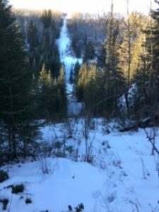
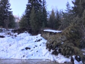
During my initial field collection and graph assignment, I learnt that presence/absence data is not the strongest indicator of plant species distribution and density (stems/m2) and ground cover (%) is a more accurate way to quantify plant species distribution. Following my initial field collection, I changed the way I was collecting data on my response variable (i.e., from presence / absence to density and ground cover for snowberry).

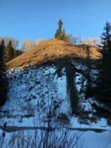
During my final field collection, I have learnt to appreciate the time needed to prepare for an efficient field sampling program. When I collected my initial field collection, I realised some inefficiencies in the way I was collecting data which I then amended before undertaking my final field collection. I was manually calculating slope incline as a percentage in the field, which I changed to using a clinometer which was much more efficient in the field. I was originally measuring out my quadrat at each location with a measuring tape and tent pegs, which was time consuming, so I took the time to make a PVC quadrat which was much more efficient in the field. I also decided to increase the data I was collecting, and added soil moisture, light exposure and pH to my field collection, which has proven to be very useful when analysing relationships in my data set.

When I was analysing my data and writing my final report, I appreciated the complexity of the natural world, where more than one or two variables would be contributing any observed patterns ecology. I was focussing on slope incline, but also looked at soil moisture, slope aspect and light exposure. On review of my data I think there are opportunities for future research to look at how these variables interact with each other through an ANOVA. I also identified some gaps and limitations in my data set, where additional study sites and additional data on soil parameters would be valuable.

I have enjoyed the content of this course and undertaking a field experiment which has increased my appreciation for ecology and ecological theory. I appreciate the use of statistics in ecology and the importance of strong data sets. My research focussed on one plant species which would be considered a relatively small-scale experiment and through my literature review I realised how my experimental design could be applied at multiple scales to guide land use planning and decision making. My literature review has increased my appreciation of scale in ecology, made me realise how my research project can be scaled up and applied to mapping systems and used by local, provincial and federal governments to guide land use planning and decision making.

I look forward to applying the knowledge and practicable skills I’ve learnt into my career as an environmental consultant.

Blog Post #8 – Tables and Graphs

User:  | Open Learning Faculty Member: 


I initially made a table noting down the percentage of leaf color change for each of the five sections for the three trees I’m observing. I realized that the table was going to very long and almost a bit unnecessary. I finished it anyways and found a different way I could represent the same information. I mafe a new table with the same dates I took the observations, keeping humidity levels and time of observations. The only difference I made was making an average percentage of color change instead of having five different percentages for each tree. Now my table is more compact and easier to read.

Next I made a graph showing the color change over time. Three colors, one for each tree. It took a while to figure out how I was going to graph this and a way to assess it. There may be some changes later, bit everything seems pretty clear now.

The outcome was similar to what I expected, but I did wonder why these trees changed color slower than all the other trees. Could it have something to do with being in a highly maintained park by the city or is it because they were bigger trees compared to the other and were more able to collect resources they needed? Maybe it could be another reason too.

Blog Post #7 – Theoretical Perspectives

User:  | Open Learning Faculty Member: 


The theoretical basis for my research is mainly based on the effect of an abiotic factor, humidity, on a biotic factor, leaf color change. Because my study is located in a city centre park, there may also be anthropogenic factors that contribute to color change in leaves.

Keywords that could be used to describe my project include: leaf color change, humidity, and city park

Blog Post 9: Whispering Woods Reflections

User:  | Open Learning Faculty Member: 


Reflecting on my field research, I have come to appreciate the importance of preparing before starting to implement research. Throughout my data collection I had to modify my predictions, hypotheses, and sampling methods multiple times. This is because the more knowledge I gained from my peers, professor, and supporting literature, the more I recognized ways of better carrying out my research project. Given the time limits in which I had to carry out the data collection, this was partly inevitable. However, for future research I will make sure I spend more time collecting as much background information as I can before implementing my data collection.

Still, by the end of my field experiment, I ended up where I initially wanted to be. For instance, while my original focus was on soil moisture and soil pH, I am now have the knowledge to know that my focus was actually dealing with autumn senescence differences. My study design and implementation was not altered much. Small changes were made to better encompass replication, randomization, and measurement accuracy, but the actual implementation went quite smoothly. The largest issues I faced were not knowing how to put my thoughts and purpose into words until I spent more time looking at supporting literature.

This research project has undoubtedly increased my appreciation for how ecological theory is developed. Through reading existing literature and carrying out an experiment myself, I have come to appreciate the value in what seems like insignificant findings. Without the existence of ecological data and results, regardless of how small, it would be impossible for researchers to draw conclusions and, eventually, create theories. I have also come to appreciate the intricate and difficult process of developing ecological theories. For my research topic specifically, there is vast research looking into what controls autumn senescence in trees. Many authors have produced similar findings and conclusions, but many have also contradicted each other. The one similarity among all of the literature I reviewed was that all have acknowledged the inability to form an theory on how autumn senescence is controlled. My research is no different. It has not solved this underlying problem. Still, my field research is one more piece of data in the ever-accumulating pool of data that will eventually help produce a theory.

Overall I really enjoyed the process of creating and carrying out field research. I enjoyed researching how my findings fit into the broader scope of existing literature, and how they are important from a big picture point of view.

That’s all!
Madeleine

Blog Post 4: Sampling Strategies

User:  | Open Learning Faculty Member: 


Hello!

For the Virtual Forest tutorial, I used “Area” rather than “distance” and performed systematic, random, and haphazard sampling. The sampling technique with the fastest estimate sampling time was systematic at 12 hours, 5 minutes. following not too far behind was random sampling at 12 hours and 46 minutes and haphazard at 12 hours and 30 minutes. The percent error for the density of the 2 most common and the rarest species are as follows:

most common: Eastern Hemlock. Haphazard: 31.24% Systematic: 25.03% Random: 16.15%

Sweet Birch: Haphazard: 17.02% systematic: 53.87% random: 32.60%

rarest: White Pine. Haphazard: 1.20% systematic: 48.81% random: 50.00%

Striped Pine. Haphazard: 42.86% Systematic: 4.57% random: 76.00%

The accuracy did not seem to change with species abundance as there is no consistent trend between the standard errors for the common species and the rare species. as well, one sampling strategy does not appear to be more accurate than the others.

Blog Post 5. Design Reflections

User:  | Open Learning Faculty Member: 


My initial field data involved the identification of lichen genera, and the collection of presence-absence data for epiphytic lichen growing on the trunk bark of 4 different tree families (Pinaceae, Cupressaceae, Aceraceae, Betulaceae) within the south western region (10-19m elevation) of Stanley Park. Individual tree trunks from each family were sampled at sites systematically, along a transect (Lees Trail). A total of 5 replicate stations along Lees trail were chosen based on accessibility, at regular intervals of approximately 150 m to span the entire ~ 1km long transect. At each point along the transect, a random number of steps were taken into the forested area (>10m) and one individual from each tree family (if available) was selected for observation. The lichen genera present on the tree trunk (< 1.4m height) were identified (using a guide), and the presence/absence was recorded for each tree.

Did you have any difficulties in implementing your sampling strategy? If yes, what were these difficulties?

I had difficulties finding trees within the deciduous families (hardwood/angiosperm) Aceraceae and Betulaceae. Often there was only one individual of either  family at each station, and coniferous members of the Pinaceae and Cupressaceae famiies always dominated the stand. Additionally, all vine maples (family Aceraceae) were much younger than the other trees measured, making it difficult to compare lichen data across tree families.

It was difficult to differentiate Hemlock and Douglas fir tree species, and they often had the same lichen genera present on their bark. I solved this in the field by grouping observations by tree family. It was difficult to identify lichen in the field, and the differentiation between Cladonia sp. (squamulose) and Platismatia sp. (foliose) lichen had to be done using photographs and physical samples upon return from the field.

It was time consuming to photograph and identify lichen on 3-4 trees, per replicate station. A recent seasonal change in weather has made spending time in Stanley Park more difficult due to the increased amount of rain.

Was the data that you collected surprising in any way?

I found it surprising that all tree families measured, had visible dust lichen (Lepraria sp.) except for the two maple trees (family Aceraceae). Western Red Cedars seemed to have the most diverse genera of lichen present on the trunk bark.

Squamulose lichen was present with and without secondary thallus structures (podetia). The Cladonia genus is known to develop cup-shaped fruticose podetia. Cladonia sp. (identified as Cladonia ochroclora ) had developed visible fruticose podetia (secondary thallus) more frequently on Western Red Cedar (family Cupressaceae) and Alder (family Betulaceae) compared to Douglas Fir and Western Hemlock (family Pinaceae).

Do you plan to continue to collect data using the same technique, or do you need to modify your approach? If you will modify your approach, explain briefly how you think your modification will improve your research.

I will continue selecting replicates systemically along the length of each trail. However, I plan to change my method by selecting trees along the very edge of the trail, to reduce any potential confounding edge- effects on lichen distribution. This type of sample selection will improve my research because replicates will be more comparable. Overall, by selecting replicates at the very edge of the trail (stand), the replicate data will be more comparable due to the potentially reduced confounding effects of location within the stand, aspect, humidity, and differential exposure to radiation.

I plan to sample 10 Western Red Cedars (Cupressaceae) and 10 Douglas fir or Western Hemlock (Family Pinaceae), within each sub-area. I plan to sample trees randomly along each trail transect, using a random number generator to select a number of steps greater than 10, but less than 20. This will maintain an aspect of random sampling in my sample selection method.

I will maintain the same data collection technique; presence absence of lichen genera below 1.4m trunk height, on all aspects of the tree trunk (north, east, west, and south- facing sides). To help identify lichen genera in the field, I plan to collect unit shape category for each replicate. I will record whether the lichen is: powdery, crustose, squamulose, foliose, or fruticose in nature. This adds a categorical morphological response variable, and also provides an alternative identification method if the genera cannot be resolved in the field.

I plan to start collecting the circumference at breast height of every tree sampled, to approximate tree age. Age will represent a potential biotic predictor variable. I will also note a description of the ground cover at each site, ranging from soil and decaying organic matter (ie. branches, woody debris, and leaves/needles) to dense vegetation (ie. understory and young trees).

Blog Post 8: Tables and Graphs

User:  | Open Learning Faculty Member: 


The graph I submitted for my Small Assignment 5 illustrates the relationship between slope incline (%) and common snowberry density (stems/m2). I added a linear trend line to my line graph to visually show that as slope incline (%) increases, the density (stems/m2) of common snowberry decreases. To produce this graph, I stratified my slope incline (%) into four distinct ranges. The ranges were 0-5%, 6-10%, 11-15% and 15%+. I determined these ranges based on my data collection. I then manipulated my data by changing the number of stems per quadrat I collected into density (stems/m2) by dividing my stems per quadrat by 2.25m2. I then calculated the average density in each slope incline (%) range, for example between 0-5% slope incline, the average density of snowberry was 15 stems/m2. Between 6-10% slope incline, the average density of snowberry was 8 stem/m2.

The linear trend line on my graph illustrates the general trend I was predicting in support of my hypothesis, that snowberry distribution is determined by slope incline (%). Specifically, I predicted that snowberry will be present in area where slope is less than 20% and that snowberry density will decrease as slope incline (%) increases.

When I was first organising my data and producing graphs, I didn’t think my results were showing the trend I predicted, and my graphs appeared cluttered with too much information. As I started to aggregate my data into different ranges and averages, my graphs appeared to show a better trend and I think they are easier for the reader to interpret.

As I am working through my data, I am noticing some trends that I didn’t predict, for example my data is showing that common snowberry is highest in Site 1 Eastern Area compared to Site 2 Riparian Area. During my initial field observations, I expected common snowberry to be at highest density in the riparian area. My data is also showing that light exposure is similar in Site 1 and Site 2 compared to Site 3 Upland Area, which could be another variable determining snowberry distribution. My soil moisture data did not show what I expected, where Site 3 Upland Area was not the driest site, where I was expecting Site 1 and Site 2 to have the highest soil moisture, and Site 3 to have the lowest, however this is not the case with my data. I also want to evaluate slope aspect (degrees) as a predictor variable.

As I am working through my final report, I will be outputting more graphs that will hopefully further support my hypothesis and show other potential trends.

Post 2: Sources of Scientific Information

User:  | Open Learning Faculty Member: 


For my source of ecological information, I have chosen a report on Mule Deer wintering habitat, titled Mule Deer Winter Habitat Model,  written by Anne-Marie Roberts (2004). The report was written for the Morice and Lakes District Innovative Forest Practices Agreement, which is a government initiative to develop innovative forestry practices in the Lakes and Morice Timber Sales Area (Ministry of Forests, 2000). The report provides information on Mule deer winter behavior such as food sources, feeding patterns, and preferred habitat, to name a few (Roberts, 2004). The document can be read by following this link: http://a100.gov.bc.ca/appsdata/acat/documents/r1526/hsm_4065_modhe_1115307201308_ee60c663264b43aba7b2a8923b1f9018.pdf

Using the tutorial How to Evaluate Sources of Scientific Information (n.d.), I have determined that the source I have chosen is non peer-reviewed academic material. I arrived at this conclusion because the source was written by an expert in the field,as the author works for a biological consulting firm (Roberts, 2004). It does have in text citations and it does have a bibliography. It does not, however, have any referees and is therefore not  peer-reviewed academic material (“How to Evaluate Sources of Scientific Information”, n.d.).

I chose to use this document on Mule Deer wintering habitat as I am extremely interested in Mule Deer behavior, and I am hoping to use this interest to help guide my research project for this course.

Sources:

Robert, A (2004). Mule Deer Winter Habitat Model. Retrieved November 20, 2019, from http://a100.gov.bc.ca/appsdata/acat/documents/r1526/hsm_4065_modhe_1115307201308_ee60c663264b43aba7b2a8923b1f9018.pdf

Ministry of Forests (2002). Innovative Forestry Practices Agreements Handbook. Retrieved November 20, 2019, from https://www.for.gov.bc.ca/hfd/library/documents/bib45953.pdf

How to Evaluate Sources of Scientific Information (n.d.). Retrieved from https://barabus.tru.ca/biol3021/evaluating_information.html#7

Post 6: Data Collection

User:  | Open Learning Faculty Member: 


My original hypothesis stated that the abundance of dandelions in the centre field of General Brock Park in Vancouver, BC was dependent on their proximity to areas of human activity.

I recently went to do some observations but the dandelions were gone, leading me to modify my hypothesis. I counted the abundance of English daisies (Bellis perennis) as well as other flowers instead.

With the help of my brother, I counted the number of English daisies, red clovers, white clovers, and dandelions in five 1m x 1m quadrats placed randomly in General Brock Park. I did not have any problems implementing my sampling design.

Post 1: Observations

User:  | Open Learning Faculty Member: 


Just north west of Fort St John, BC,  lies Charlie Lake. From the southern tip of this lake runs Fish Creek. Fish creek is a small creek that runs approximately 14 km, flowing first south east and then turning northeast to flow in to the Beatton River. I have chosen to observe a roughly 2.5 km section of the creek about 3/4 of the way along it’s path towards the Beatton River (Google Maps, 2019). The above measurements are very rough estimates.

In the area I have chosen for study, Fish Creek snakes its way through a rather steep gully. I visited the area on 19-11-17 at approximately 1510 until 1630. It was unusually warm for November at 9 degrees Celsius. It was quite windy (I guessed it was 30 km/hr gusting 50 km/hr out of the south west) but sunny. I will try to remember to bring my Kestrel next time to get a more accurate weather reading.

On the south facing bank of the gully itself the flora is predominantly grassy with some smaller shrubs, most likely Prickly Rose (Rosa acicularis). At the top of the slope on that south facing side there stands mostly Trembling Aspen (Populus tremuloides). Behind that lies farmed crop fields (these fields will not be included in my study as they are private land). At the bottom of both sides of the gully, directly adjacent to the creek, there are flat, sort of swampy areas with Prickly Rose and what I am pretty sure is Blue Wildrye (Emlymus glaucus), though it is hard to tell at this time of year, and a “willow” shrub that I do not know the name of, though it has been on my list of plants to learn for a while now. What I do know is that moose love it as a forage. I have observed in many other locations the tops of this shrub neatly snipped off by the big mammals.  The north facing slope is predominantly a stand of mature White Spruce (Picea glauca) with the odd Paper Birch (Betula papyrifera) and Trembling Aspen. The under story is mostly Blue Wildrye and Prickly Rose (making it somewhat unpleasant to walk through). There are pockets of Trembling Aspen stands on mid slope benches. At the top of the north facing slope there is a band of mixed trees, though most are Trembling Aspen. Behind this there lies a golf course. I will be including this grassy course in my study area as I access the Fish Creek gully (which is Crown Land) via the public path through the golf course. I access the lower part of the gully via a pipeline right of way that runs straight down the north facing bank and then up the south facing bank on the far side. The right of way is open grass with some White Spruce regeneration.

Pipeline Right of Way

Golf Course (looking west)


One observation I noted was the difference in apparent slope instability between the north facing and south facing slopes. There is fairly abundant evidence of slides and slope instability on the south facing slope at all levels. On the north facing slope, there is considerably less, though still some evidence down low. Perhaps this has to do with the north facing slope having a gentler pitch and mid level benches? Perhaps the presence of White Spruce provides better stability? Maybe because snow melts faster due to sun exposure on south facing slopes (Williams, 2018) the slope becomes saturated and is more prone to slide? I would be very curious to look in to the relation between the south facing slope and its apparent instability.

South facing slope (instability present)

Northern bank instability along creek

I saw one Common Raven (Corvus corax), but no other live animals. I have seen many Red Squirrels (Tamiasciurus hudsonicus) in the general area and was therefore surprised to not see any on this visit. I find these little squirrels very endearing and will be keeping an eye open down there for them. What do they do in the winter in this area? Do they prefer the White Spruce to the Trembling Aspen? Do they prefer the slopes or the flat lands? I imagine that they go in to hibernation for the winter months, but I do not actually know that for a fact.

In the grass land up top, I observed (and have many times in the past while in the area walking my dogs) heavy traffic by Mule Deer (Odocoileus hemionus), as evidenced by their hoof prints in the snow. I was expecting to follow their trail all the way down the pipeline right of way to the bottom of the gully and then along the creeks edge. They did not appear to go all the way down though, and I am not sure at which point they veered from the right of way. This is a question that I am very interested in researching. What are the winter traffic patterns of Mule Deer in the area? Where do they bed down? Where do they feed? Do they prefer the open south facing slopes to the flat golf course? How does snow pack affect their behavior? I chose my area of study knowing that Mule Deer frequent the area and will likely base my research on their patterns in this area, where man-made field meets forest and gully.

Mule Deer tracks

I also noticed several Canine tracks in the snow on the pipeline and down at the bottom of the gully. There were many sets of tracks, traveling along the creek’s edge and crisscrossing it. There appeared to be different size of tracks. Perhaps Red Fox (Vulpes vulpes) or Coyote (Canis latrans)? I am confident they are not some one’s dog as the area in the gully has no paths or human traffic (aside from me) evident. I am interested to understand more about these canine’s travel patterns though the area. It would be interesting to find out if they prefer to run over the frozen creek (when it does freeze), or on the flats beside the creek. Does snow depth or slope have an effect? Does the presence of these canine’s affect the Mule Deer in the area?

I have started these observations at a good time of year as the season is shifting from fall to winter. I will be using this seasonal change to help me focus my study.


Sources:

Google Maps. (2019). Retrieved November 20, 2019, from https://www.google.com/maps/@56.278364,-120.8526553,7633m/data=!3m1!1e3

Williams, D. (2018). Differences Between North- and South-Facing Slopes. Retrieved November 20, 2019 from https://sciencing.com/differences-between-north-southfacing-slopes-8568075.html