User: | Open Learning Faculty Member:
As I stated earlier, Cottonwood park is a place I go to very regularly to walk my dogs. I have been having troubles pinning down an organism or an attribute that I can study, as it cold, there is 10-20cm of snow on the ground, and the majority of the plant species are dormant or hidden, and identification between branches can be difficult.
One thing I noticed were the rosa sp. species, as some still have their rose hips persisting through the cold. It may be possible that there are actually two different species of rose, Rosa acicularis (Prickly rose), and Rosa nutkana (Nootka rose). I thought if I could differentiate between the two, I could study if one species had more rose hips persisting through winter than the other. However, differentiating between these closely related species is difficult even when there are leaves and flowers, let alone when there are just decaying fruiting bodies.
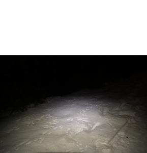
Moving forward, I made some more field observations this morning (December 24). I walked the loop on the east end of my study area from 6:00-7:00am. The temperature was -7 degrees, with a wind chill of -15 degrees, and the sky was overcast. It was still dark and everything is always very quite at this time. It is rare that I see anyone. However, this is the time of day where I usually see the local fox and hares. Unfortunately, I did not see either this morning, but I did see a high amount of hare tracks, of all different sizes (Figure 1). I see a surprising amount when walking in the morning, as my headlamp allows for attributes to stand out.

Figure 1: Hare tracks in the snow.
Though I find the animal aspects of the park very interesting, I think it would be troublesome to study as I will always have my dogs with me when I am at Cottonwood, which usually leads to most wildlife running away.
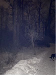
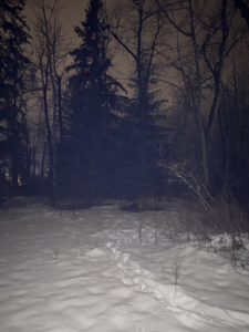
Next, I thought I would focus on the flora of the area. Concentrating on the island portion of the park, I noticed that there were some areas that contained more coniferous tree species than others. This area is predominantly Cottonwood (Populus balsamifera), with large veterans in the overstorey, and the multiple clones in the understorey, as well as many other riparian type woody shrubs and herbaceous plants (Figure 2).


Figure 2: Left, photo showing large veteran Cottonwood trees; Right, photo showing more coniferous trees.
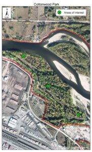
With that said, I have decided to study the density of coniferous trees on different parts of Cottonwood island. I am going to use three areas. There is an inlet from Nechako river that makes a portion of this park an island. I am going to use this as my gradient. An area at the intake of the inlet, one in the middle, and one at the end of the inlet (Figure 3). My initial observation is that there are more coniferous trees around the middle section of the island inlet. I believe this is because the areas near the beginning and the end of the inlet are narrowing and closer to the Nechako and inlet water, increasing soil moisture , thus increasing the density of Cottonwood trees that are able to out-compete the coniferous species. I believe there is a relationship between the density of understorey cottonwood and the density of coniferous species, and my hypothesis is, that in areas with less cottonwood regeneration, there will be more coniferous trees.

Figure 3: Locations at Cottonwood park island along the gradient.
The response variable in this study are the Coniferous trees and the predictor variable are the number of regenerating cottonwood stems. Both my response variable and predictor variable are categorical as they will be classified into presence/absence counts.

Hi snuyens,
I feel the topic you’ve chosen to study after visiting this site multiple times is an excellent choice to sample during the winter season when so many other things there are either hidden or dormant.
I’m curious how you will go about choosing your sample plots, for example, will you create a list of random coordinates and then plot them on a map? or maybe sample a random area after a set number of paces?
Also, have you researched the history of the park itself? It’s possible that some of the layout of conifers and cottonwood is due a variety of anthropogenic factors such as the area being forested in the past or ongoing maintenance by parks staff. I think I’ll have to do this for my own project so it came to mind.
Looking forward to your progress!
– Brian