Recent Posts

Blog Post 2: Sources of Scientific Information

User:  | Open Learning Faculty Member: 


The paper I chose was ‘Winter ecology of striped bass (Morone saxatilis) near its northern limit of distribution in the Saint John River, New Brunswick’ written by S.N. Andrews, T. Linnansaari, R.A.Curry, N.M. Leblanc and S.A.Pavey.

This is an example of an academic, peer-reviewed research paper. It is considered an academic paper because the authors are all affiliated with universities in New Brunswick and therefore it can be deduced that this research was conducted as part of their professional work. Furthermore, the paper includes in-text citations and a reference list at the end, adding to the academic nature of the report.

It does not explicitly state that it is peer-reviewed, however, it does list “received” “accepted” and “published” dates at the beginning of the paper. Furthermore, the journal in which it was published, Environmental Biology of Fishes, only accepts peer-reviewed articles, as stated on their website:

“All papers must undergo the normal peer-review process, which includes the possibility of rejection. This process will be handled by the guest editors within the online reviewing system. The Managing Editor will provide proper training to the guest editors as requested.” (Environmental Biology of Fishes: Submission Guidelines).

It is a research paper because it reports original research, and includes ‘results’ and ‘methods’ sections. It does not synthesize or review research from previous studies, therefore it is not a review paper.

References:

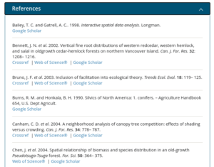
Andrews, S.N., Linnansaari, T., Curry, R.A., Leblanc, N.M. & Pavey, S.A. (2020). Winter ecology of striped bass (Morone saxatilis) near its northern limit of distribution in the Saint John River, New Brunswick.Environ Biol Fish 103, p 1343–1358. https://doi-org.ezproxy.tru.ca/10.1007/s10641-020-01027-x

Environmental Biology of Fishes: Submission Guidelines. [website]. Retrieved from: https://www-springer-com.ezproxy.tru.ca/journal/10641/submission-guidelines on December 30, 2020.

Blog Post 1: Hay River, NT

User:  | Open Learning Faculty Member: 


The site that I chose for my field study is an area along the bank of the Hay River in Hay River, Northwest Territories. The river park extends for about 2.2km from the Vale Island Bridge to the local high school. I chose an approximately 1.5km long by 50m section of the park to focus on for the study. The northern border is demarcated by the northern trailhead entrance near my house. The eastern boundary includes the Hay River watercourse, which is currently frozen in a thick layer of ice. The southern boundary is the end of the trail which leads up to the parking lot of the Power Corp office building. The western boundary is demarcated by Riverview Drive.

My initial site visit was conducted on January 6, 2021 at 15:15. It was partly sunny and -7 degrees Celsius. The day was particularly warm for this time of year, as average temperatures have been hovering around -25 degrees. The area is heavily snow covered; a full visualization of flora and fauna was limited.

This area would be classified as a town park bordered by residential zoning and is comprised of riparian and woodland areas. Through the park runs the Kiwanis Trail, a walking path that was enlarged in summer 2020 to make it more accessible for walkers. This included clearing brush from the sides and packing down dirt on the trail to make it a more even surface. A section of the trail which runs behind the high school and then up to the Power Corp was not enlarged or cleared and has been left to become overgrown with plant life and fallen trees.

The park contains a lush array of woody trees, shrubs, brushes, grasses and flowering plants. On the eastern side, the riverbed has a steep eastern facing slope covered with brush, shrubs, and flowering plants. This steep slopes levels off to the river bottom below and the frozen Hay River. In the spring through fall, I have encountered a variety of wildlife in the area including sand hill cranes, groundhogs, squirrels, various birds, black bears and lynx. On my winter site visit I observed only one brown squirrel and a few small brown birds.

Upon exploring the area, I developed four questions which will act as the base for my future study and analysis of the area:

  1. Did the widening of the Kiwanis trail (including removal of brush) impact wildlife biodiversity and habitats in the area?
  2. Does biodiversity and wildlife behaviour differ between the cleared section of trail and the trail left intact?
  3. How did summer 2020’s record high water levels impact the vegetation, slope stability and wildlife in the area?
  4. How will the area change through the seasons? This includes migration of species and growth of plant life in the spring.

Blog Post 2: Sources of Scientific Information

User:  | Open Learning Faculty Member: 


The source of scientific information I have chosen for this post is titled Spatial patterns and competition of tree species in a Douglas‐fir chronosequence on Vancouver Island. The article was found using google scholar and can be accessed here: https://onlinelibrary.wiley.com/doi/full/10.1111/j.2006.0906-7590.04675.x

Based on the module 1 tutorial on how to evaluate sources of scientific information I would classify this source as academic, peer-reviewed research material. My reasoning is as follows.

The authors are all affiliated with either universities or relevant scientific research centres as shown in Figure 1. This demonstrates relevant expertise on the subject matter.

Figure 1: Author Affiliation

The material also has both in-text citations and a bibliography listing all sources used as shown in Figure 2.

Figure 2: Bibliography

The material is published in the journal Ecography which has a double-blind peer review process for publishing content as described in their author guidelines shown in Figure 3.

Figure 3: Double Blind Peer Review

Lastly, the paper contains both a methods and results section demonstrating that it has undergone research as shown in figures 4 and 5.

Figure 4: Methods Section

Figure 5: Results Section

Blog Post 1: Field Observations

User:  | Open Learning Faculty Member: 


Field Observations – Matthew Peterson

The area I have chosen for this study is Pipers Lagoon, located in Nanaimo B.C. I visited the area on January 9th at approximately 9:40 am. The weather was mainly cloudy with a few sunny breaks, ~4 degrees in temperature, and fairly windy. Low tide in this area had occurred at 7:39 am.

The entire park area is approximately 8 hectares in size and consists of a tidal mudflat (the lagoon), an approximately 300m long tombolo or sandy isthmus, and a rocky headland or tied island. It is a well-visited site year-round, with a somewhat rugged trail system that loops the entire tied island. Elevation change is approximately 20m (according to alltrails.com) between sea level at the tombolo and the high point on the tied island.

The tombolo which has a relatively flat topography and predominantly grassy vegetation connects the mainland Vancouver Island with the rocky headland or tied island. The eastern side of the tombolo is exposed to the open ocean, consists of an abundance of dunegrass, and has a predominantly pebble-sized substrate. The Western side which is exposed to the lagoon waters generally lacks dunegrass but has an abundance of various other smaller-sized grasses and has a much smaller and finer substrate. 

Figure 1: Looking North Towards Tied Island Along Tombolo

The lagoon itself undergoes daily tidal fluctuations but was pretty well entirely underwater when I arrived. The tied island which is approximately 5 hectares in size consists of multiple rocky outcrops where various lichen, moss, and broad-leaved stonecrop were observed. The smaller rocky outcrop was dominated by mainly Garry Oak, with a couple small arbutus also observed. The main tied island had a variety of vegetation including Ocean Spray, Nootka Rose, and the invasives Spurge-Laural and English Ivy. Tree species observed here were Douglas Fir, Garry Oak, and Arbutus. The northern, exposed portion of the tied island was dominated by Douglas Fir, while the south-facing side formed a typical Garry Oak ecosystem, with Camas known to bloom here in the Spring.

Figure 2: Garry Oak and Douglas Fir on Tied Island

The area is well known for birding and I was fortunate to observe several species including Mallard, Bufflehead, Glaucous-Winged Gull, Bald Eagle, White-Crowned Sparrow, Black Turnstone, and a Varied Thrush.

Figure 3: Varied Thrush in Garry Oak


Potential Study Questions

Based on my initial field observations here are three questions that may form the basis of my study.

Question 1: Does exposure to salt spray determine the abundance and distribution of the Broad-Leaved Stonecrop?

It was noted that the stonecrop was generally found along bluffs exposed to the ocean as opposed to the lagoon.

Question 2: Does the difference in substrate composition of the lagoon compared to the beach (on the other side of the tombolo) impact species diversity?

Although the tide was up fairly high I imagine the species diversity between the lagoon and the beach area must be at least somewhat impacted by the substrate.

Question 3: Do the tree species composition and diversity change from mid tied island to the perimeter with sun exposure?

It was noted that the majority of Garry Oak on the tied Island were concentrated on the more southern facing side, while the Douglas Fir was denser in the north direction.


Field Notes:

Blog Post 5

User:  | Open Learning Faculty Member: 


When implementing my sampling strategy, I found that the process was harder than expected. It required me to be home most of the day and watch the location consistently to make sure I didn’t miss any possible sightings. However, I decided for more efficiency to implement time windows which helped significantly.

The data collected were in line with my hypothesis, I will continue with this method of information collection as I believe it’s the best and easiest to complete with current climate conditions.


Blog Post 4

User:  | Open Learning Faculty Member: 


For the virtual forest tutorial, I used the area-based model for my systematic, randomized, and haphazard sampling of vegetation. The most efficient method of sampling for my results was systemic sampling. On common species, it had a percentage error of 3.71% versus 18.75% for random and 9.48% for haphazard sampling. The technique which required the least amount of time was the random method. However, all sampling techniques had very similar sampling times with random being 12hrs 20mins, systemic was 12hrs 37mins and haphazard was 12hrs 25mins. The percent error for the rarest species was best using the haphazard sampling technique. It seems that the systematic approach is more useful for common species as it didn’t take up many rare species, and the haphazard sampling was more accurate for the rarer species.

Blog Post 2: Sources of Scientific Information

User:  | Open Learning Faculty Member: 


I chose an article entitled, Feeding ecology of Atlantic bluefin tuna (Thunnus thynnus) in the Gulf of Saint Lawrence, Canada found in the Thompson Rivers University (TRU) Library. The article can be found in Marine Environmental Research.

Looking over this article, and from what I learned in our tutorial, I believe this is an academic peer-reviewed research article.

I’ve deemed this article as academic primarily due to the contributing authors and their affiliation with the Biology Department at Acadia University in Nova Scotia, Canada (Figure 1). Two other contributing factors are that the journal this article was published in is considered a research journal (Figure 2) and secondly, TRU Library allows one to be able to refine their search to retrieve academic journals (Figure 3). The article would also be considered academic due to the amount of in-text citations (Figure 4) and the reference list at the end of the article (Figure 5).

I believe the article is peer-reviewed based off of the timeline outlining the manuscript received date, the revision date, and the publication date (Figure 6) and as previously mentioned, I specifically searched for peer-reviewed articles in the TRU Library (Figure 7).

References

Varela, J. L.,  Spares, A. D., Stokesbury, M. J. W. 2020, October 16. Feeding ecology of Atlantic bluefin tuna (Thunnus thynnus) in the Gulf of Saint Lawrence, Canada. Marine Environmental Research. V 161. 105087, ISSN 0141-1136. Retrieved from https://doi.org/10.1016/j.marenvres.2020.105087.

Figures

Blog post 3

User:  | Open Learning Faculty Member: 


I watched my chosen area on Jan 5th, 2021 throughout the day from my garden. I decided to conduct my field research study on the presence of white-tailed deer. Specifically, the distribution and number of them across the three locations I identified along the environmental gradient.

The 3 locations I chose were as follows: open field, city road and residential area. The deer did not venture into residential, however, in the other locations, they tended to be present.

Deer’s travel in a herd to protect against potential predators.

My prediction is that the open space has the most vantage point to observe any potential threat and therefore they would most likely aggregate in this area.

One potential response variable is the number of deer (continuous)One potential predictor variable is the amount of access to the open field without the presence of a threat (categorical).

Based on the experimental design tutorial my experimental design would be classified as ANOVA

Post 8: Tables and Graphs

User:  | Open Learning Faculty Member: 


When creating my graph, I found it hard to properly display the diverse content I was recording neatly in one space. When attempting to create separate graphs, they showed no correlation with the point I was trying to prove. Upon its completion, I found it lacking in the specifics while not being laid out the way that was expected for the course. I was able to show the correlation between my points of research and the topic I am studying. My data was lacking water pollution and land pollution levels that I could not measure with current equipment. I feel that would provide a more accurate picture of long term effects of pollution on creek health.

Blog Post 1: Observations

User:  | Open Learning Faculty Member: 


I’ve had to change my location, so this is an updated observation. I choose to pick a bigger location closer to my house. I decided to pick a length of the dyke along a common road in Surrey, BC. The length of the dyke is about .6 km. I choose this location due to the about of wildlife and components of the environment along the dyke. The top of dyke A (dyke B is running parallel) is well worn, but always a quiet dyke in comparison to dyke B. The two dyke paths are separated by a large canal of water, about 15 feet across. There is a combination of tall yellow grass and brambles that make it difficult to venture down to the canal, but entirely possible.

As it was a clear day, there were plenty of animals out. I heard several hawk or falcon calls, crows in the surrounding trees, some human traffic from the nearby roads, construction from the nearby complexes and a tractor in the blueberry field on the right side of dyke A (if facing SE). There was evidence of animals from the scat along the trail, paw prints in the mud, ducks and a few loons swimming in the canal and crows flying overhead.

There was plenty of plants that I was not familiar with. Brambles along the shoreline, tall yellowing grass on either side of the dyke, green short grass along the trail with spots of clover and dandelion weeds. Mixed into the tall yellowing grass there were brown tall plants with seeds and dying flower heads of some sort. I was not familiar with them, but they might potentially be thistles.

Overall, it was a great first observation of this location. I have many things to ponder about how to create my hypothesis and test it out.

A few questions I had:

  1. How does precipitation effect the dyke’s ecology system?
  2. Does the dyke water levels rise and fall frequently?
  3. Are there bugs and fish that I was not able to observe?
  4. How does the blueberry farm effect the dyke?

I’m looking forward to returning, observing the nature another day, and answering some of my questions. Below are some of my field notes from my adventure.